
Station Name: ANNITSFORD (2nd site)[Source: Alan Young]
old1.jpg) The up (east) platform of Annitsford station looking north-east from the up platform c1906. The North Eastern Railway’s favoured twin pavilion style of building with an enclosed verandah clasped between the wings is seen here, but the gables are unusually tall. This was the only station building in Northumberland thought to have bene designed by William Peachey (Chief NER architect 1876-77).
Photo from John Mann collection 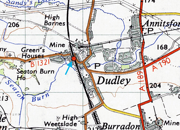 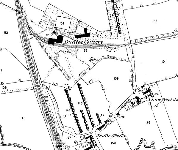 1858 1: 2,500 OS map. Dudley Colliery has recently opened (1856) but a station has yet to be provided: it would open in April 1860 on a site between the road underbridge and the railway line into the colliery. The first Annitsford (originally Dudley Colliery) station seems not to have been shown on any large scale OS map.
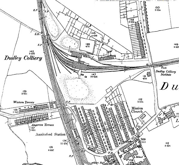 1897 1: 2,500 OS map. The original station is not named, but the buildings either side of the East Coast main line - immediately south of the minor road crossing, and close to the point where the colliery branch lines lead south-eastwards - were presumably the station. The signal box is on the down side, immediately north of this crossing. The second station can be seen with the principal building on the east (up) platform and a waiting shed on the west platform. The colliery pit-heap can be seen north-east of the road bridge. The village of Dudley Colliery has expanded during the previous forty years 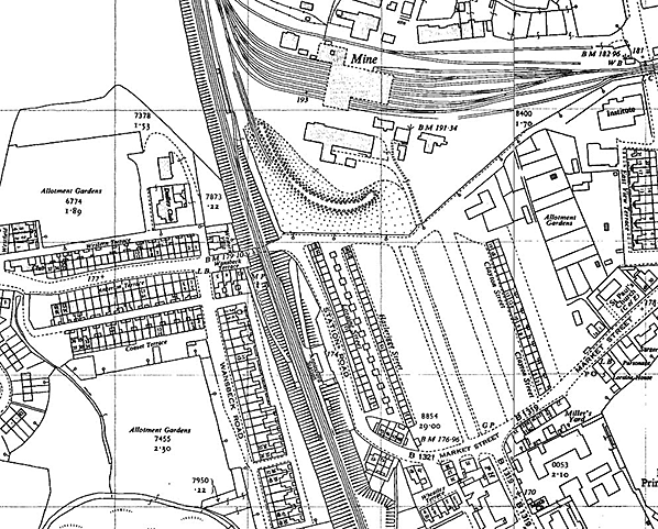 1962 1: 2,500 OS map. The station has now closed to passengers and is no longer named on the map, but will remain open for goods traffic until November 1963. Ironically, small housing estates built since 1920 have considerably increased the population of Dudley Colliery village, but the train service was much less frequent than buses, and the station closed in 1958.
old3.jpg) In September 1957 D20/1 62396 draws a southbound passenger train into Annitsford station. The LNER running-in nameboard has been repainted in BR(NE) tangerine and is accompanied by an NER casement gas lamp. In the background the pithead gear and spoil heap - locally called a ‘pit-heap’ - of Dudley Colliery are prominent; Dudley Colliery signal box is far left, close to the site of the first Annitsford station, which opened as ‘Dudley Colliery’. The 4-4-0 locomotive is a Worsdell design built by the NER at its Gateshead works in September 1907. It originally carried the number 1665. It was withdrawn from 52D, Tweedmouth shed, in December 1957 and cut up at British Railways’ Darlington works, North Road, in the same month.
Photo by Les Turnbull old2.jpg) In 1958, the year of the station’s closure to passengers, the main building on the up platform at Annitsford is photographed from the down platform, looking south-east. The North Eastern Railway’s favoured twin pavilion style of building with an enclosed verandah clasped between the wings is seen here, but the gables are unusually tall. This was the only station building in Northumberland thought to be designed by William Peachey (Chief NER architect 1876-77). The presence of a figure on the coiled serpent bench (another NER feature) suggests that the photograph was taken before the station closed to passengers in September 1958.
Copyright photo from Stations UK 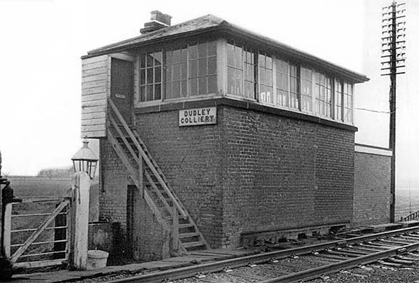 Dudley Colliery signal box stood north of Annitsford 2nd station and was formerly called Annitsford Colliery Junction. The N1 style NER structure was erected in the early 1870s, and this view dates from between 1962 and 1980. Changes in the brickwork indicate an extension to the northern end of the structure in 1920 and a further single-storey addition in 1962. The first extension was made to accommodate a larger lever frame when additional up and down line capacity was installed by the NER between Annitsford and Dam Dykes, to the north. The box was decommissioned in January 1980.
Photo by BR(NE) from Chris Woolstenholmes collection 1.jpg) Weestlade Road bridge, looking south in July 1987. The second station, long demolished, was on the far right side of the photograph. The pit heap of Dudley Colliery (now Weetslade Country Park) can be seen in the background, to the right.
Photo
by John Mann
2.jpg) The embankment on which Annitsford second station was located is seen on the right. This view from August 2005 is looking south along Station Road, close to the site of the station’s main building.
Photo by Steven Hedley from his Flickr photostream 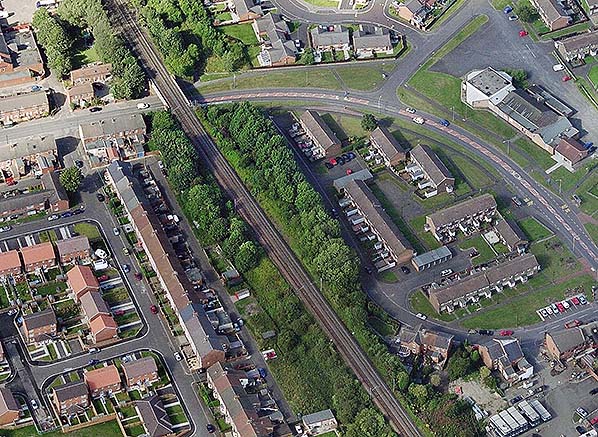 A recent aerial view of the site of Annitsford second station. The station - of which there is no visible evidence today - was on the embankment in the centre of the picture. Station Road is immediately to the right (east) of the railway, and the station building was located on this road at the near end of the grove of trees.
| ||||||||||||||||||||||||||||||||||||||||||||||||||||||||||||||||||||||||||||||||||||||||||||||||||||||||||||||||||||||||||||||||||||||||||||||||||||||||||||||
 Notes: ‘The second Annitsford station was 16 chains (352yd) south of the station that it replaced. It was more conveniently sited than its predecessor to serve the village of Dudley where the colliery workers lived. The station took its name of Annitsford from a hamlet almost a mile to the east to avoid confusion with Dudley (Worcestershire) and Dudley Hill (West Riding of Yorkshire). It is noteworthy that the NER was prepared to avoid confusion not only between stations on its own network but with stations operated by other companies.
 The new station acquired a building designed during the very short period (1876-77) when William Peachey was NER Architect. Peachey had designed various stations in the Darlington area (such as Etherley and Marske) before his promotion, and Annitsford is the only one outside that area which appears to be entirely his own work. Despite being unmistakeably Gothic in inspiration, in other respects it was unlike the other Newcastle – Berwick stations both in its design and the materials of its construction – it was in brick rather than sandstone - and Fawcett (2011) remarks that it bore all the hallmarks of Peachey’s style. He describes it as a neat, stern-looking H-plan building, presenting one storey at platform level but with another floor below. The pair of tall, assertive gables had two-light windows divided by a colonnette, rather than a mullion, and they gained their severe, heavy appearance from the large expanse of brick, latterly blackened by soot, above the windows. Between the gables was a verandah with a sloping roof and a glazed timber front. This main building was on the up (east) platform and small waiting shed was provided on the down side.
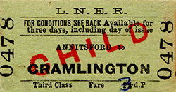 Shortly before World War I NER statistics indicate that a population of 6,719 was served by Annitsford station, and that 41,932 tickets were booked (1911 data). In 1913 bricks and livestock were the principal goods traffic.
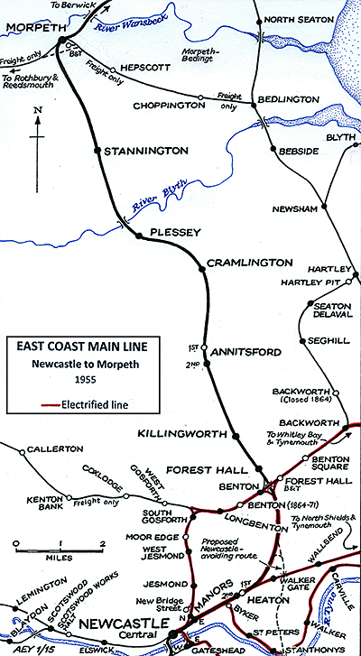 The first two morning departures would have been suitable for Annitsford passengers who worked in Newcastle but there was only one convenient return train in the evening ‘rush hour’. From 1 January 1948 Annitsford was operated by British Railways’ North Eastern Region, who repainted the nameboards in the striking tangerine livery, but in other respects left the station unchanged.
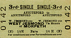 Goods traffic was dealt with at Annitsford until 11 November 1963. The station was demolished by the late 1960s.
 Home Page