
Station Name: BRIERY SIDING HALT[Source: Alan Young]
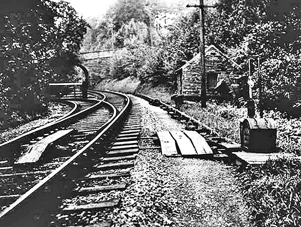 Looking north-east c1935, Briery Siding is seen diverging to the left of the line between Keswick and Threlkeld. The workmen’s platform is out of sight, immediately beyond the overbridge that carries the lane to Briery Bobbin Mill. The ground frame which controls the points is in the foreground.
Photo by Richard L Pattinson, courtesy of Cumbrian Railway Association, 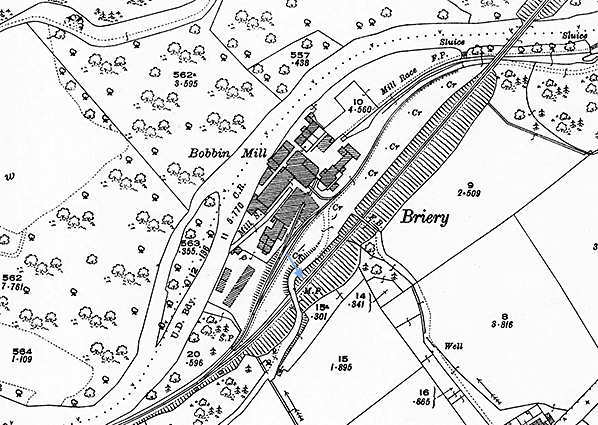
1924 1: 2,500 OS map. Briery Siding Halt was not shown on Ordnance Survey maps. The platform was immediately north-east of the bridge carrying the road to the Bobbin Mill (named) on the up (north-west) side of the track. The layout of the mill sidings, installed in the 1890s, is clearly represented. The River Greta forms the north-western boundary of the mill. The Mill Race diverting water from the river upstream to provide power to the mill and the Mill Stream which returns water to the river are both identified on the map. Click here for a larger version of the map.
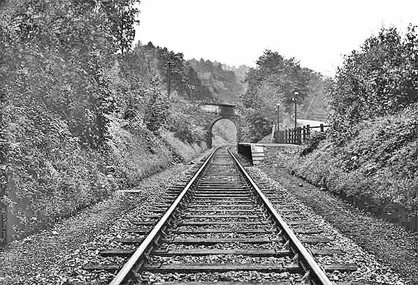
Looking south-west towards the single platform of Briery Siding Halt; the date is unknown. Access to the platform was via a wicket gate from the mill yard and lane (right).
Photo by Richard L Pattinson, courtesy of Cumbrian Railway Association 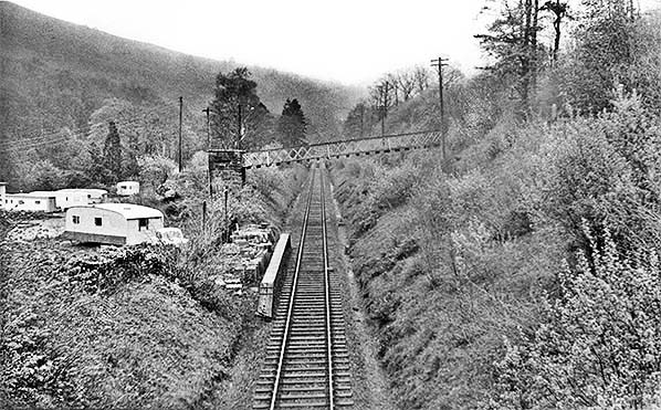 Briery Siding Halt, looking east from the overbridge in May 1966. Although the platform is in place it has been out of use since 1958.
Copyright photo by John Alsop 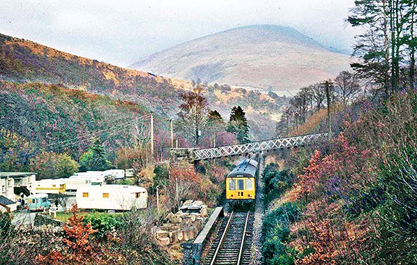
A Class 108 diesel multiple unit bound for Keswick is about to pass the disused Briery Siding Halt c1970.
Photo from John Clark collection 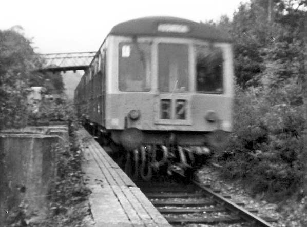 A class 108 DMU is seen passing thorugh the closed Briery Siding Halt c1971. A class 108 DMU is seen passing thorugh the closed Briery Siding Halt c1971.Copyright photo by John Charters from Cumbrian Railway Association 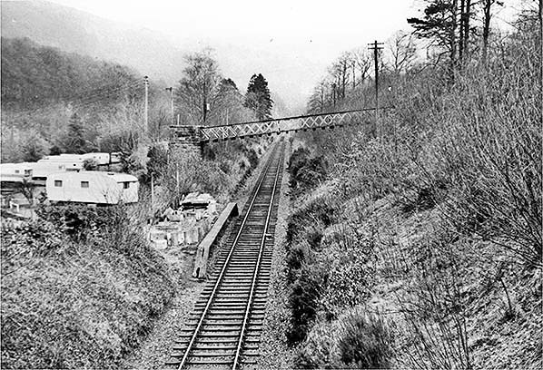 Briery Siding Halt, looking east from the overbridge in February 1972. Although the platform is in place it has been out of use since 1958. The line through the station would close to all traffic in March 1972. Briery Siding Halt, looking east from the overbridge in February 1972. Although the platform is in place it has been out of use since 1958. The line through the station would close to all traffic in March 1972.Photo by John Mann  The disused Briery Siding Halt, looking east in February 1972.
Photo by John Mann siding9.jpg)
Briery Siding Halt looking south-west in summer 1988. A cycle route follows the trackbed of the railway for much of the distance between Keswick and Threlkeld. The lane that once served Briery Mill now gives access to the cycle route.
Photo
by Danny Bedlam
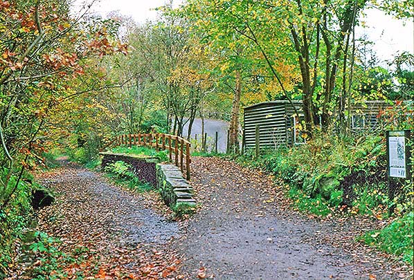
Looking south-west in October 1988 towards the platform of Briery Siding Halt. The lane to the right passes over the trackbed by means of a stone arch bridge beyond the platform, obscured by the trees. An interpretation board about the Bobbin mill is seen on the right.
Photo by Alan Young siding12.jpg)
|
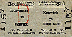
 Soon after 1922 a timber platform was constructed close to the siding, on the up side of the single track, immediately north- east of the bridge which carried the lane to the mill. A wicket gate gave access to the platform directly from the mill yard. One up train called in the morning to enable workers to arrive from Keswick and Cockermouth, and a down train collected them in late-afternoon on Monday to Friday, and at lunchtime on Saturday. These calls were omitted from the public timetable. As with some other private and ‘untimetabled’ stations, the halt serving the mill has been known by more than one name; Croughton et al (1982) refer to it as Briery Siding Halt, as this name was used on workmen’s tickets, but Bowtell (1989) and Quick (2009) prefer the more colourful Briery Bobbin Mill Halt.
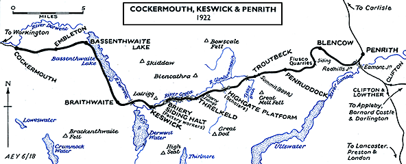
 The mill closed in November 1958 and a week later trains ceased to call. At this time the siding layout (expanded in 1906 and 1911) was in place but latterly used only for inbound coal. The private siding Agreement with the railway was officially discontinued on 17 October 1959.
 Home Page