
Station Name: SEATON SLUICE[Source:
Alan Young]
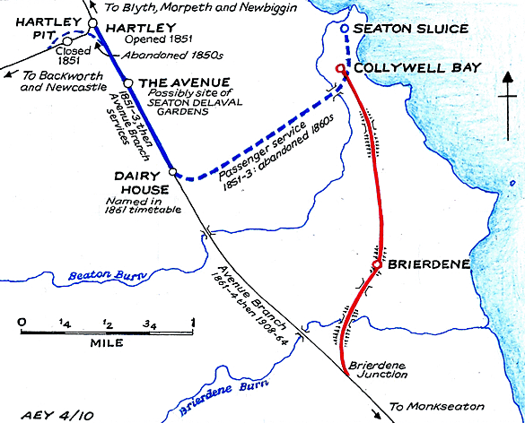
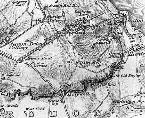
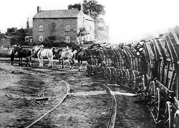 There are no known pictures of the Seaton Sluice waggonway but this view shows the similar Little Eaton Gangway with a gang arriving at Little Eaton - note the rails are flanged rather than the wheels. The Seaton Burn waggonway ran on an east-west course through Burradon and Camperdown. It was built by the Grand Allies in stages (1826 and 1837) from Brunton Colliery to the staiths on the Tyne between Wallsend and North Shields. At a later date the line was connected to the Blyth and Tyne railway via a line running towards Backworth.
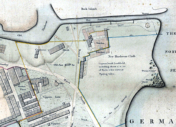 1821 MapThe Seaton Sluice waggonway is shown with several short branches. It is not clear where passengers would later join and alight from the trains. 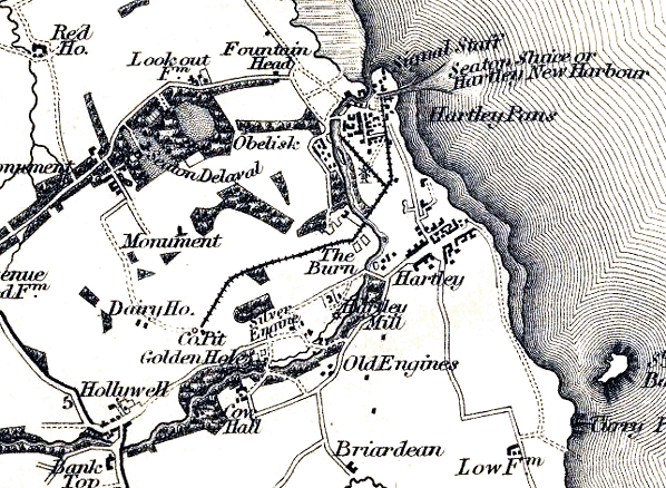
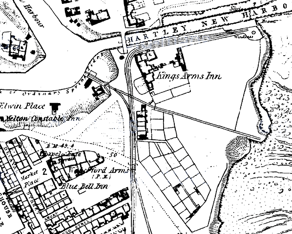
1828 1:63,360 OS Map. The original waggonway is shown from the coal pit west of Hartley to the harbour, with a branch to the north-west. No viaduct is indicated over Seaton Burn, but it must have been constructed many years earlier. Although the village of Hartley is shown south of Seaton Sluice, the later station of this name was located in New Hartley, 1½ miles to the north-west.
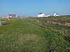
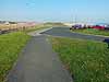
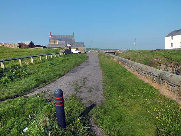 It is unlikely that the waggonway had any kind of platform for passengers to disembark. This view shows the course of the waggonway looking west from its terminus alongside Hartley New Harbour in May 2012. This is the likely point for passengers to have disembarked. The building at the end of the road is the Kings Arms Inn which is contemporary with the waggonway.
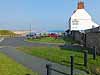
Photo by Roy Lambeth 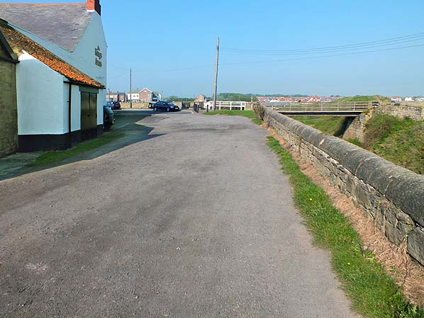 Looking west along the course of the Seaton Sluice waggonway in May 2012. At this point the waggonway turned sharply to the south around two sides of the Kings Arms Inn which is seen on the left. Hartley New Harbour is seen on the right.
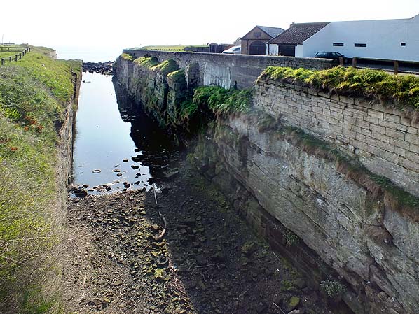
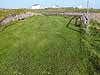
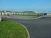
New Hartley harbour looking east in May 2012. The waggonway terminus was on the
right behind the wall. Photo by Roy Lambeth
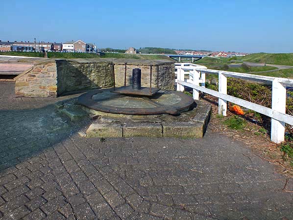
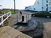
The base of a windlass or horse gin close to the sharp bend in the waggonway by the Kings Arms Inn. A windlass is shown on the 1821 and 1860 maps above at the end of the line. An unidentified circular structure is shown at the point where the waggonway turns to the east. It seems likely that this was used for haulage on the waggonway although it has also been suggested that it was used for pulling boats through the Hartley New Harbour.
Photo by Roy Lambeth
| ||||||||||||||||||||||||

 Home Page