Notes: On Monday 16 July 1894 the Donegal Railway company (DR) opened a station of their own at Strabane. The station was the eastern terminus of the DR system which at that time extended to Donegal and Killybegs. The section of line between Strabane and Stranorlar had actually opened on 7 September 1863 as the Finn Valley Railway (FVR) and it was laid to the Irish standard gauge (5ft 3inch). When the FVR opened it connected just outside Strabane station to the Londonderry & Enniskillen Railway (L&ER), the first section of which had opened on 19 April 1847, at Strabane and it shared that company’s station there. The lines of the West Donegal Railway to the west of Stranorlar opened in 1882. This line was built to the 3ft gauge which meant that passengers had to change and goods had to be trans-shipped at Stranorlar. In 1893 powers were obtained to convert the former FVR to 3ft gauge and to construct a new section of line and a station at Strabane.
 At the time of opening the FVR station at Strabane consisted of just a single platform which had a run around loop. On the platform there was a single storey brick building with canopy that provided the passenger facilities. The station was located directly to the west of the L&ER facility which by 1894 was part of the Great Northern Railway Ireland (GNRI). At the time of opening the FVR station at Strabane consisted of just a single platform which had a run around loop. On the platform there was a single storey brick building with canopy that provided the passenger facilities. The station was located directly to the west of the L&ER facility which by 1894 was part of the Great Northern Railway Ireland (GNRI).
To the north of the passenger station there were goods facilities, trans-shipment sheds and a locomotive shed which were adjacent to the GNRI main line. To the south there was a goods store and sidings.
A signal cabin controlled the layout. It was located to the south of the passenger platform on the west side of the line.
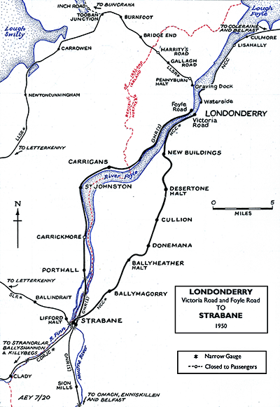
Although the DR had eradicated the need for trans-shipping goods between gauges at Stranorlar by 1894 they now had the same issue at Strabane. A great deal of the DRs traffic was generated at the city of Derry/Londonderry and on 7 August 1896 they obtained an act which allowed them to build a line between their station at Strabane and Derry/Londonderry which was on the east bank of the River Foyle opposite the GNRI line to Foyle Road station. This followed a course on the west bank of the Foyle, and that company had objected to the DR plans. The new line opened to a new terminus station called Londonderry Victoria Road on 1 August 1900 for goods, with passenger services starting on 6 August.
The DR system continued to expand with their last 2 new branches opening in 1905 (to Ballyshannon) and in 1909 (to Letterkenny). The new branches all brought additional traffic from County Donegal to Strabane.
For the opening of the Letterkenny branch in 1909 some alterations were made to the station at Strabane. The platform was lengthened and widened and made into an island with two faces. Some additional sidings had also been laid by this time and the locomotive depot had been enlarged. A new signal box, further to the west than the original (adjacent to the Letterkenny branch) was also provided by 1908 and with of a typical NCC design.
 In 1903 the Midland Railway (MR), an English company, had acquired the Belfast & Northern Counties Railway. The MR was very interested in expanding its Irish operation and it offered to purchase the DR. The GNRI saw this as a threat and tried to block it. A compromise was reached whereby both companies jointly acquired the DR. On 1 May 1906 the County Donegal Railway Joint Committee (CDR) came into being. However it was agreed that section from Strabane to Victoria Road would be owned by the Midland Railway but operated by the CDRJC on their behalf. In 1903 the Midland Railway (MR), an English company, had acquired the Belfast & Northern Counties Railway. The MR was very interested in expanding its Irish operation and it offered to purchase the DR. The GNRI saw this as a threat and tried to block it. A compromise was reached whereby both companies jointly acquired the DR. On 1 May 1906 the County Donegal Railway Joint Committee (CDR) came into being. However it was agreed that section from Strabane to Victoria Road would be owned by the Midland Railway but operated by the CDRJC on their behalf.
After the partition of Ireland into two separate countries in 1921 (Northern Ireland and The Irish Free State) the CDR system found itself located within two separate countries with all of the difficulties that imposed. Only the Strabane – Londonderry Victoria Road line lay wholly within one country, Northern Ireland.
In 1923 the MR became part of the London, Midland & Scottish Railway (LMS) and so that company became the partner of the GNRI in the running of the CDR. The Northern Ireland government nationalised the country’s railways and had set up the Ulster Transport Authority (UTA). In April 1949 the UTA purchased the NCC from the Railway Executive and by default their share of the CDRJC. This meant that the line between Strabane and Londonderry Victoria Road passed into their ownership, but train services along that branch continued to be operated by the CDR.
 There was contraction of the CDR network from 1947 onwards and on 1 January 1960 all rail passenger services were withdrawn and the Strabane CDR station closed to train services. On 15 February 1965 the GNRI Strabane station (part of the UTA since September 1958) also closed. Both stations remained in a derelict state until 1989 when the last remains were finally demolished for a road scheme. There was contraction of the CDR network from 1947 onwards and on 1 January 1960 all rail passenger services were withdrawn and the Strabane CDR station closed to train services. On 15 February 1965 the GNRI Strabane station (part of the UTA since September 1958) also closed. Both stations remained in a derelict state until 1989 when the last remains were finally demolished for a road scheme.
CLICK HERE FOR A DETAILED HISTORY OF STRABANE (CDR) STATION
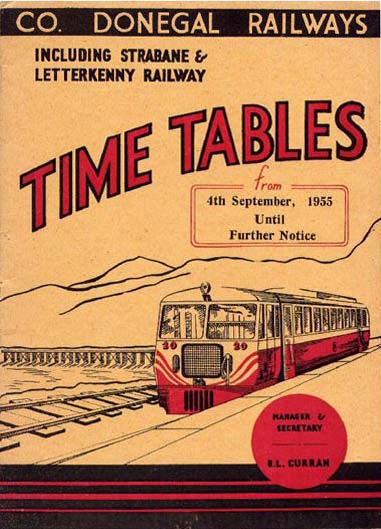
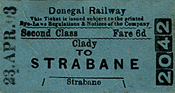
Tickets from Michael Stewart and the Donegal Railway Heritage Centre. Timetables from Chris Hind and Jim McBride. Route map by Alan Young
Sources:
- Begley, J et al The County Donegal Railway - A Visitors Guide (County Donegal Railway Restoration Society, 1999)
- Bunch, M Michael Bunch's Donegal Railway Diary Part 1 1954-1955 (County Donegal Railway Restoration CLG, 2017)
- Bunch, M Michael Bunch's Donegal Railway Diary Part 1 1956-2018 (County Donegal Railway Restoration CLG, 2019)
- Challoner E, Fairwell the Derry Road (Colourpoint, 2010)
- Johnson, S Johnson's Atlas & Gazetteer of The Railways of Ireland (Midland Publishing, 1997)
- Patterson, E M The County Donegal Railways - Revised Edition (Colourpoint,2014)
See also: Strabane (GNRI)
To see the other disused
stations on the Londonderry Victoria Road and Strabane railway click on the station
name: Londonderry Victoria Road, New Buildings, Desertone Halt, Cullion, Donemana, Ballyheather Halt and Ballymagorry
Click here to see the Donegal Railway Heritage Centre website
|

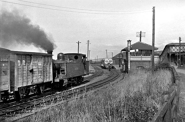
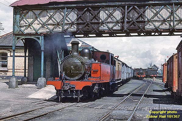 Strabane 'CDR' station looking north on 22 June 1958. The station can be seen to the left of CDR locomotive number 4 'Meanglas' which is shunting wagons. In the distance locomotive number 6 'Columbkille' can be seen. To the right the former GNRI station can be seen. The two stations were linked by a footbridge which can be seen above the train.
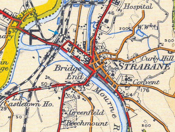
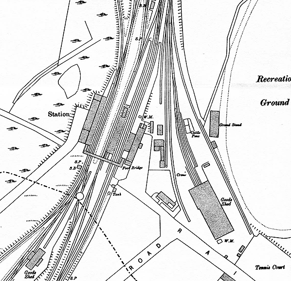 The stations at Strabane shown on a 25-inch scale map from 1905. The station to the left was at this time still under the ownership of the Donegal Railway who had opened it in 1894. At this time it had just a single platform which was adequate for the level of traffic that it handled. The GNRI station is to the right. The stations are linked via a footbridge. Click here to see all of the railway facilities that existed at Strabane when this edition of the OS map was drawn in 1905.
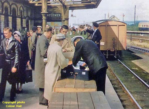
 Looking north towards the Strabane CDR station on 31 August 1959. This view shows the Letterkenny side of the station. The Letterkenny branch had opened in 1909 and an extra platform was provided at the station. Standing at the platform is a CDR railcar waiting to depart for Letterkenny. A goods train is seen in the foreground heading north towards the station.
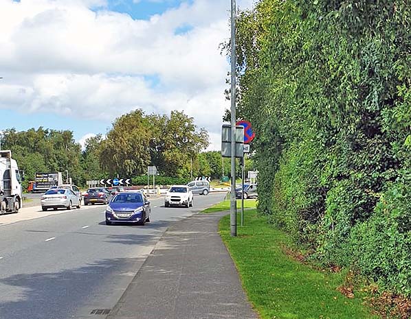 The site of Strabane CDR station looking south on 18 July 2020. The photographer is standing roughly at the point where the Stranorlar line platform would have been. The GNRI station was located to the left and extended to the mid-point of the roundabout.
 Home Page