
Station Name: SCARNING[Source: Glen Kilday]
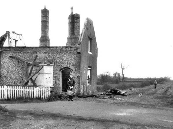 Looking east from the site of the level crossing at the site of Scarning station in 1975. Scarning gatekeeper's house was roofless by this time and woukd be demolished the next year during the construction of the East Dereham bypass (A47).
Photo from Scarning Village web site 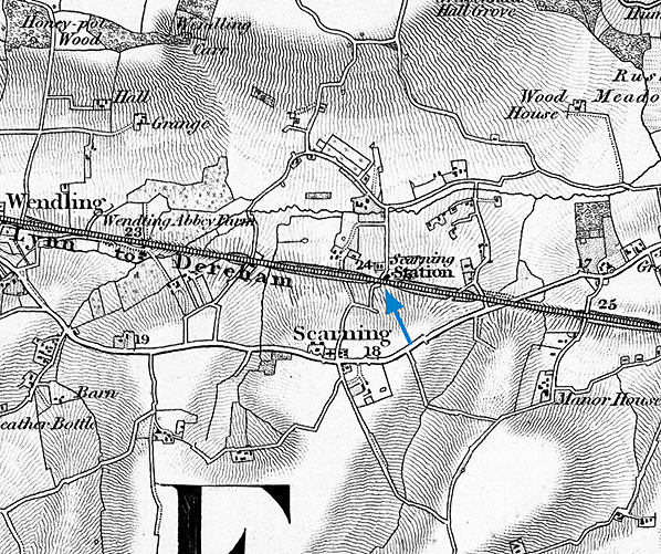
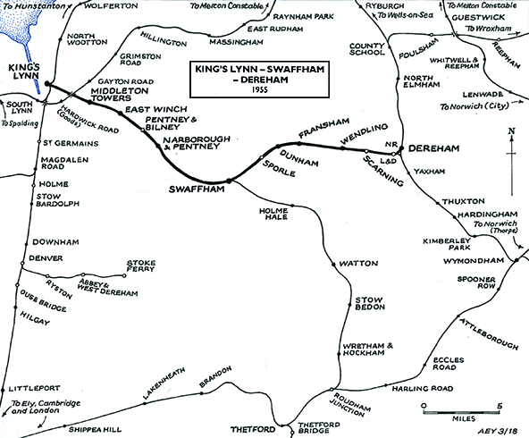
1859 1:63,360 (1" Norwich sheet 66) map. Although published in 1859 the survey woukd have been some years earlier.
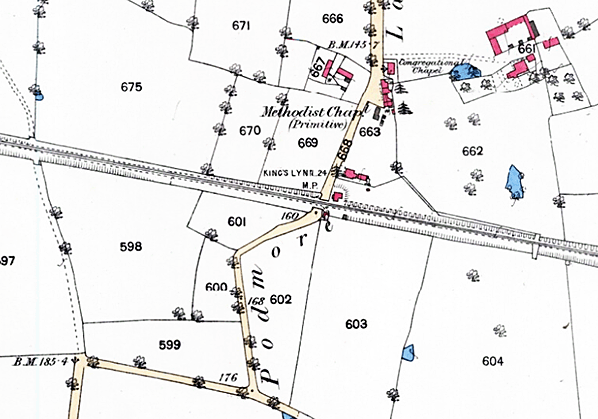
1884 1:2,500 OS map. There is little to see at Scarning except the former station house still in place beside the road crossing.
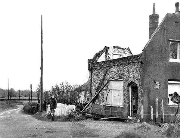 Scarning gatekeeper's house was roofless by this time and woukd be demolished the next year during the construction of the East Dereham bypass (A47). The ticket office for Scarning station would have been in the house.
Photo from Scarning Village web site 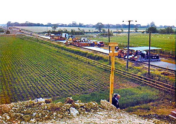
Constructiuon of the East Dereham bypass (A47) along the line of the railway line at Scarning in 1976.
Photo from Scarning Village web site 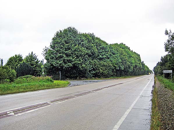
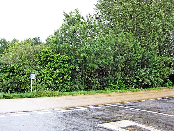
The view east along the line of the railway in September 2017. The station building was where the trees stand on the northern corner of Chapel Lane.
Photo by Glen Kilday 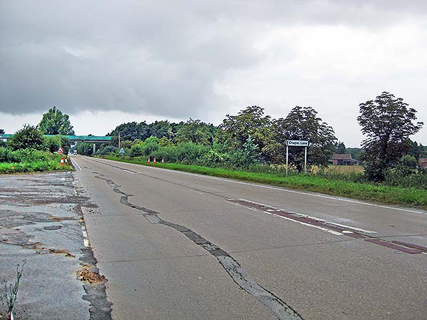
The view to the west from the approximate location of the up side of the railway line, as seen in September 2017.
Photo by Glen Kilday 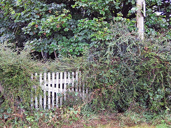 Small section of picket fence or gate is in the hedgerow at the site of the station house in September 2017. It resembles fences at other stations on the Lynn & Dereham and is very similar to the fencing seen in the 1975 photos above.
Photo by Glen Kilday
|

 Home Page