Note: On 28 November 1946 the Traffic, Property, Works and Locomotive committees of the LNER received a government memorandum that between 2,000 and 3,000 staff of the Ministry of National Insurance were to be transferred from offices in Team Valley (Gateshead) to temporary buildings (constructed with the help of German prisoners-of-war) close to Benton Park Road, with the number of employees predicted to rise to 8,000 by the end of 1947. The former Blyth & Tyne railway passed close to the site, and ‘the provision of a halt between South Gosforth and Benton stations’ was recommended to improve access to the new government buildings.
 |
The ‘halt’ was to have two platforms with shelters (awnings) on both of them. The south ‘up’ platform (for trains direct to Newcastle) was to have the main building containing a passimeter booking office, ladies’ waiting room, gents’ lavatory and staff accommodation. A covered footbridge would connect the platforms. No provision was to be made initially for |
dealing with parcels, bicycles or luggage, but the facilities would be designed to permit them to be handled, with minimum expense and inconvenience, should the need arise.
The estimated cost of the halt (including ¾-acre of land) was £15,000; staffing costs were estimated at £1,000 and gross receipts at £10,000 per annum. Passenger trains were expected to call between 7.00 am and 10.00 pm on weekdays. As to funding the project, the LNER considered that ‘pending housing development, the halt will be used almost wholly by MNI employees and, in view of that Ministry’s request for the facilities to be provided, it is considered that there is a good case for asking for the work to be carried out at the expense of the government’. However, on 13 February 1947 the Ministry of Transport decided that the LNER should foot the bill because ‘the need for the halt will remain for a very long time since it is hoped to provide permanent [MNI] offices eventually [and] the Ministry also state that there is a projected housing estate nearby which will probably lead to further traffic of a permanent nature’. (Less than a year later the LNER ceased to exist when the railways were nationalised.) The MOT agreed to the new halt being named Longbenton after the Urban District in which it was located.
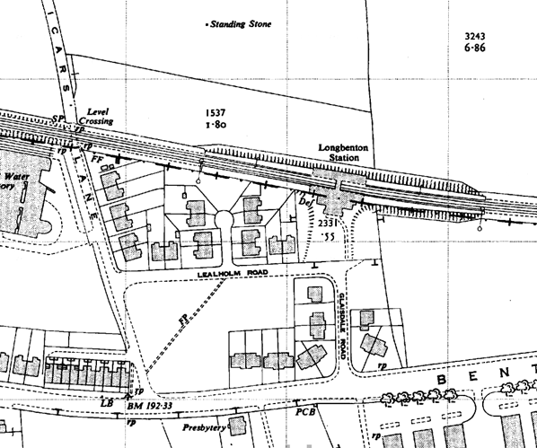
| Land for the halt was acquired from Balliol College, Oxford (300 sq yd), William Jackson (2,359 sq yd) and Brigadier General Sir J F Laycock’s trustees who released the new landholder from a restrictive covenant on selling intoxicating liquor! Newcastle Corporation provided 1090 sq yd on the understanding that the LNER would construct access to the halt on the north |
 |
(‘down’) side when the corporation had completed fifty houses in the projected housing estate. The estate (known as Longbenton) directly north of the station was developed as a ‘slum clearance’ re-housing scheme by Newcastle Corporation on land belonging to Northumberland: construction began in 1952 – and the author lived there from 1955 until 1973.
Although described as a halt in the planning stages, Longbenton station opened on 14 July 1947 - the last to be opened by the LNER. However it was not included in the final LNER timetable book issued on 6 October 1947, nor was it added in the amendments of 3 May 1948 (issued by British Railways). In the first BR (NE) timetable of 31 May 1948 its Coast Circle electric train service was approximately hourly – whilst other stations were served every twenty minutes – with additional calls in morning and evening rush hours and at lunchtime; the final call was at 9.30 pm. A few trains to or from Newbiggin also called at Longbenton. Remarkably an hourly service was provided between 10.16 am and 8.30 pm on Sundays, presumably for the benefit of local residents who lived on Benton Park Road and in a small development of housing immediately south of the station.
 |
Longbenton station is built of dull red brick in a neo-classical style, in Bill Fawcett’s words ‘an essay in flat-roofed modernity, influenced by Holden’ whose designs for London Underground stations are justly famous. Its frontage, facing south and giving direct access to the ‘up’ platform, ‘builds up as a symmetrical sequence of rectangular shapes, culminating in a boxy footbridge’. The entrance has a wide opening flanked by pairs of square brick pilasters and porthole windows, below an entablature of artificial stone. The platforms are backed by screen walls behind the cantilevered awnings. It is likely that the buildings were incomplete when the station opened. Like all other Coast Circle stations (except Benton) Longbenton received electric lighting with the standard LNER ‘mint imperial’ shades and nameplates. Wooden running-in nameboards with raised letters were installed, but not of the ‘diamond’ design used at the other stations. |
 |
As Longbenton estate spread across the damp fields north of the station its residents could reach the station entrance, south of the line, by using Vicars Lane crossing, west of the platforms; a full weekday daytime train service (until about 10.00 pm) was introduced in winter 1954-5. In about 1956 a way in to the north platform was opened, lacking the dignity of the southern entrance. By summer 1957 trains had begun to call late at night, and by the following summer all trains called on Sundays. In about 1958 a concrete footbridge was constructed over the platforms to provide a means of crossing the line, other than via the station footbridge; this was to replace Vicar’s Lane crossing which was considered dangerous, and closed. About the same time waiting rooms were added on each platform, extending beyond the awnings (towards the west of the ‘up’ platform and the east of the ‘down’ platform) but they were partially dismantled in the early 1970s, following damage by vandals who also kept the station daubed with graffiti.
 |
Longbenton station received BR (NE) tangerine vitreous enamel running-in nameboards in 1959/60, but retained the LNER name tablets. BR totem signage was not installed. From January 1967 the station was within British Rail’s Eastern Region, the North Eastern having been abolished. By the end of the 1960s the third-rail electric multiple units (dating from 1937) had |
given way to diesel multiple units, with a slower service and the longstanding 20-minute frequency of trains reduced to half-hourly intervals; an express service each hour did not call at the station. The station was looking distinctly shabby, and the new Tynerider branded services – the same old DMUs with jolly orange transfers added to them! - introduced in October 1970, whilst restoring the 20-minute interval service, did little to make the station more attractive. In 1972 the inadequate LNER platform lighting was removed and tall, vandal-proof standards were installed. The following year black-and-white ‘corporate identity’ signage was added (but soon had to be replaced, when it was drawn to BR’s attention that the name should be one word, not two!) and soon afterwards the tangerine running-in boards were removed.
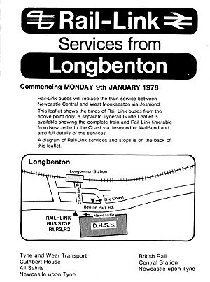
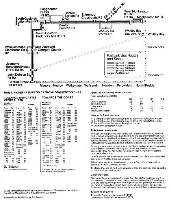
In 1973 Royal Assent was given to the development of a rapid light transit Metro system for Tyneside. To enable work to proceed, on 23 January 1978 the line from Manors North (inclusive) through Longbenton to Tynemouth (exclusive) was closed. The platforms at Longbenton, formerly about 550ft in length, were substantially shortened, but the station which reopened with Metro signage and electric units drawing their power from overhead wires was otherwise little altered.
| In 1999 Longbenton station underwent major refurbishment, at last giving the northern side an entrance of some interest. Fawcett describes the new addition as ‘striking’, but regrets that ‘the footbridge [was] swept into this with a jazzy piece of superimposed roof, which jars with the rigour of the original concept’. An additional footbridge, with ramp |
 |
access, was built at the east end of the station.
Longbenton station did not handle goods traffic. However about 100yd west of the station, immediately west of Vicars Lane level crossing and south of the tracks, two sidings served the Lucozade factory, with access from the west. The sidings were abandoned before the closure of the line for Metro conversion, and houses now occupy the factory site.
The government establishment, always referred to by local people as ‘The Ministry’ but officially known as ‘Benton Park View’, expanded to employ over 10,000 staff in the 1970s. The facilities have been rebuilt and currently accommodate Her Majesty’s Revenue and Customs and the Department for Work and Pensions. Longbenton Estate, which gained an unenviable reputation for social deprivation in the 1960s-80s, experienced dramatic redevelopment from the mid 1990s with Single Regeneration Budget funding. It is now a much more attractive mixed development of private, housing association and council property.
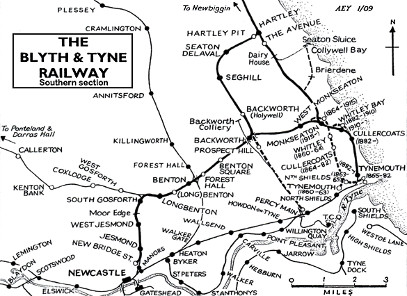 |
BRIEF HISTORY OF BLYTH & TYNE RAILWAY (Newcastle [New Bridge Street] – Jesmond – Benton – Backworth)
The southern end of the Blyth & Tyne Railway has a complicated history. Until 1861 there was a single route from Blyth and Seghill onward through Prospect Hill to Percy Main, with a terminus adjacent to the NER station. However in that year a new branch
was opened, following the route of the former Whitley Waggonway, extending from Hartley to Tynemouth. It should be noted that this included the stretch to what is now Monkseaton, which was to be known as the ‘Avenue Branch’, and that the line beyond to Tynemouth was half a mile inland of the present day Monkseaton – Tynemouth Metro line.
 |
At the Tynemouth end the original terminus was quickly replaced with a new one on a short branch which curved south eastwards, and that in turn closed when its branch was extended to a third terminus, which adjoined the 1847 Tynemouth terminus of what had been the Newcastle & North Shields Railway.
Bridge Street) to Tynemouth, making the Holywell – Prospect Hill – Percy Main route, and the ‘Avenue Branch’ between Hartley and Whitley (Monkseaton) redundant. These two lines closed in June 1864 on the day when the Newcastle – Tynemouth service was inaugurated.
In 1874 the B&T was absorbed by the NER, and the opportunity was taken to reorganise the railway routes in the Monkseaton / Whitley / Tynemouth area. With the growth of housing and holidaymaking on the coast the ‘inland’ route from Monkseaton to North Shields was superseded in1882 by one within sight of the sea, and the two formerly competing termini at Tynemouth were replaced with a splendid new through station. This created the coastal section of the familiar Coast Circle and Metro route, although there were to be realignments at Whitley |
Bay in 1910 and Monkseaton in 1915 where new, larger stations were built.
In response to the growth and electrification of street tram networks on North Tyneside the Coast Circle route via both Wallsend and Carville was electrified in 1904 on the third rail system, and the irregular and infrequent steam service was replaced with a frequent interval service. For almost six decades the basic pattern was three trains per hour in each direction, with extras in the rush hour.
| In 1963 the Reshaping of British Railways (‘Beeching’) report made no reference to the main Coast Circle line, but the Riverside Branch, via Carville, was recommended for closure (which was eventually implemented in 1973). However on a visit to Tyneside shortly after the report’s publication Beeching |
 |
made it clear that the Coast Circle line was a likely candidate for closure. In the mid 1960s the ageing electric multiple units, dating from 1937, were being allowed a few more minutes to complete their journeys, and the decision was made to replace them with diesel multiple units cascaded from other areas rather than with newer electric stock. In June 1967, shortly after the line became part of British Rail’s Eastern Region – the North Eastern having been abolished - the last EMUs ran, and the third rails were removed.
 |
The service of three stopping trains per hour in each direction was replaced with a half-hourly service, plus one ‘express’ serving only the coastal stations, Wallsend and Manors; it is no surprise that custom was lost at the stations whose service was cut. However in October 1970 the tide turned, and the Eastern Region |
launched the vigorous Tynerider campaign to revitalise the line (including the Riverside branch) and the South Shields branch. Although the Riverside continued to have a sparse service at rush hours only, the Coast Circle’s 20-minutely service returned, with the new feature of trains in the early hours to bring revellers home from Newcastle city centre. Passenger numbers increased dramatically, and strengthened the case for further investment. The idea of incorporating the local railways into a rapid transit system was examined, and in 1973 Royal Assent was obtained to use the Coast Circle as the basis of such a network, which was to become the Tyne & Wear Metro.
The engineering work to bring about this transformation was ambitious, involving the driving of tunnels under central Newcastle and Gateshead and constructing a sixth bridge over the Tyne between these centres, so that the Metro could be separated from the ‘main line’ system. For some time between January 1978 and November 1982 all of the stations on the Coast Circle (except Tynemouth) were closed for conversion work to be done: this included West Jesmond, South Gosforth, Longbenton, Benton, and West Monkseaton on the former B&T Newcastle route, thus their inclusion in the list of Disused Stations. Backworth closed in 1977 and Manors North in 1978 and were not to reopen on the new Metro line (although Manors underground station replaced Manors North, and Northumberland Park was opened in 2005 immediately south-west of the site of Backworth).
| Almost all of the Newcastle – Backworth route remains as part of the Metro system. Only at the southern end has there been any significant change. A short distance north of the original Jesmond station the Metro route of 1980 curves to the south-west to enter the tunnel beneath central Newcastle and the new |
 |
Jesmond station.
Click here for a list of sources and a Blyth & Tyne bibliography
Click here to see an article written by Alan Young for Geography Review about the development and regeneration of the Longbanton Estate. Alan was an estate resident from 1955 - 1973.
Specific sources and further reading on Longbenton
- A history of North Eastern Railway architecture Vol 3 Fawcett, Bill (NERA 2001-05)
- National Archive: RAIL 390/1891 Provision of a Halt between South Gosforth and Benton stations
- Suburban railways of Tyneside Young, Alan (Martin Bairstow 1999)
- Young, Alan Urban renewal: Longbenton Estate in Geography Review Vol 17 No 1, September 2003 (Philip Allan Updates)
Fawcett, Bill A history of North Eastern Railway architecture: Volume 3 (NERA 2005)
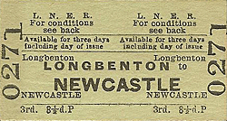
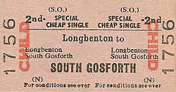
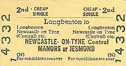
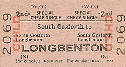
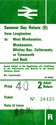
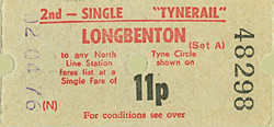
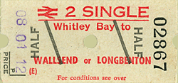
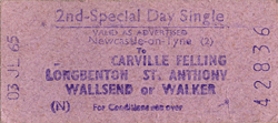
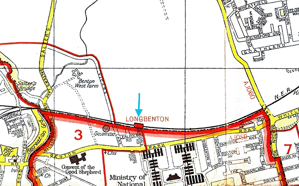
Tickets from Michael Stewart & Alan Young. Timetable from Alan Young. Street map from Rod Davey. Route map drawn by Alan Young.
To see other stations on the Blyth & Tyne Railway Newcastle - Backworth line click on the station name: Newcastle New Bridge Street, Manors North, Jesmond, West Jesmond*, Moor Edge, South Gosforth*, Benton (1st site)*, Benton (2nd site)*, Forest Hall, Benton Square and Backworth (2nd site).
* Station reopened as part of the Tyne & Wear metro. Three other Metro stations on this line are new sites and are not included. These are Palmersville, Northumberland Park and Ilford Road. |

old15.jpg)
old3.jpg)
old11.jpg)
old14.jpg)
9.jpg)
10.jpg)
13.jpg)
14.jpg)
17.jpg)
2.jpg)
old2.jpg)
old6.jpg)

 Home Page