Station Name: BRADLEY & MOXLEY |
| Date opened: |
10.6.1862 |
| Location: |
East of Bradley Lane |
| Company on opening: |
Great Western Railway |
| Date closed to passengers: |
Last shown in April 1915 timetable |
| Company on closing: |
Great Western Railway |
| Present state: |
Demolished |
| County: |
Staffordshire |
| OS Grid Ref: |
SO963951 |
| Date of visit: |
5.11.2016 |
|
Notes: The construction of a railway north from Birmingham Snow Hill to Wolverhampton, through to Priestfield, where it would meet the Oxford, Worcester & Wolverhampton Railway (OWWR) was authorised on 3 August 1846 to the Birmingham, Wolverhampton & Dudley Railway (BWDR). The BWDR favoured leasing the line to the Great Western Railway (GWR) from the outset as it planned the line to be constructed to the GWR’s broad gauge (7ft 0¼in) rather than what was, increasingly, the standard gauge (4ft 8½in). Negotiations with the GWR in regard to leasing and running the line started on 12 November 1846, only months after the railway company had been incorporated, and by Act of Parliament of 31 August 1848 the BWDR was purchased by the GWR prior to any construction taking place. Construction of the line was started by the GWR during 1851 and by June 1852 the original Act was due to lapse and the GWR successfully applied to Parliament for a 3½-year extension to the original Act. The GWR had attempted not to construct the line at all preferring to negotiate with the London & North Western Railway (LNWR) to gain running rights along the Stour Valley line; negotiations failed as the, ever suspicious, LNWR was attempting to delay the GWR reaching its ultimate goal, Liverpool.
Construction of the Snow Hill to Priestfield section of the BWDR was complete by the summer of 1854 and the line was duly inspected by Captain Sir Douglas Strutt-Galton in August. It is not recorded, whether or not the inspection was a success, but, the following day a tubular bridge over the turnpike road at Winson Green collapsed following the passage of a contractor’s locomotive working a ballast train. Isambard Kingdom Brunel visited the line the following day and a thorough inspection of the bridges along the route with John Mc Clean, the resident engineer, resulted in five of them being condemned. The opening of the line had been set for 1 September 1854 but this was now unachievable as remedial work on the structures was to take some months. Following the strengthening of the five bridges the line was again inspected and passed fit for traffic, opening on 14 November 1854.
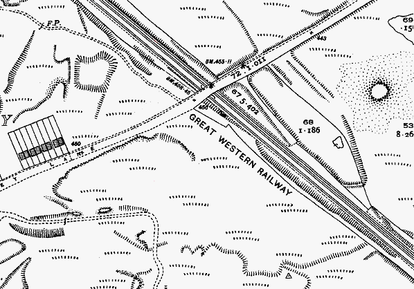
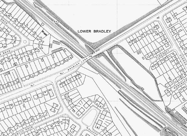
Bradley & Moxley station opened on 10 June 1862 and was a basic two-platform affair. It was located south-east of Bradley Lane. From map evidence the station was provided with a single building on the down (Wolverhampton direction) platform and one large and two small buildings on the up (Birmingham direction) platform. Access to the station was via inclined ramps from Bradley Lane. No goods facilities were provided at the station.
The station site was equidistant between the two settlements after which it was named, with Bradley being the larger of the two; however, the village was located closer to the former Oxford, Worcester & Wolverhampton Railway (OWWR) station, Daisy Bank, than the BWDR one. Various industries were located within walking distance of the new station, including Bradley Pottery and Regent Iron Works. The village of Moxley was located directly on Holyhead Road, now the A41 High Street, which was linked to Wolverhampton by the tram network.
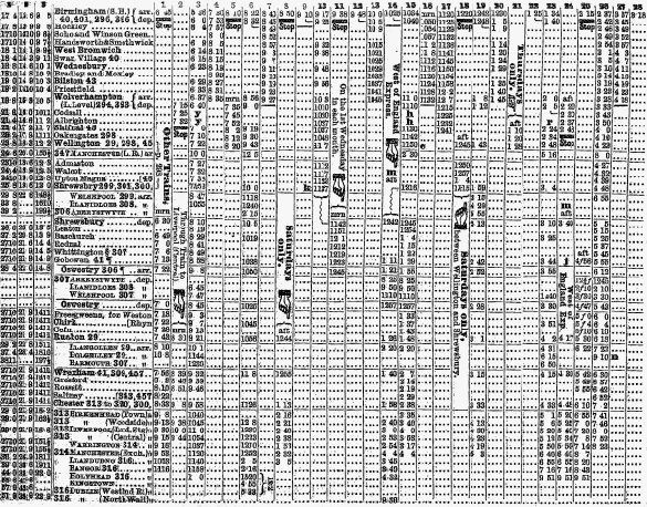 |
The service at Bradley & Moxley was nearly as sparse as the population that it it served; Bradshaw’s December 1895 timetable showed 10 down workings (Wolverhampton direction) and 11 up workings (Birmingham direction) on weekdays with four down workings and, a measly two up workings on Sunday. The notable long-distance workings through the station would be the 3.14pm Leamington Spa to Birkenhead Woodside and the 12.23pm Wolverhampton Low Level to Bournemouth East (later renamed Bournemouth Central). Both operated on weekdays with no direct return working. The 3.14pm service is shown in the extract from the timetable, above.
Passenger numbers were therefore never going to be high and during the First World War, along with many other minor stations around the country, Bradley & Moxley was closed as a wartime measure to release staff for military duties. The Railway Clearing House Handbook has the station closing on 29 March 1915 whereas the Railway Clearing House Chronology Group lists the date as 1 May 1915 as the station was still listed in the timetable in April 1915. As with many others the station never reopened after the cessation of hostilities although it continued to appear in Ordnance Survey maps until the early 1920s. Ironically, several new housing developments sprung up in the area around the station site from the late 1920s but by this point the station site had been levelled to allow a down (Wolverhampton direction) loop to be constructed thus increasing capacity on the twin-track section between Priestfield and Wednesbury.
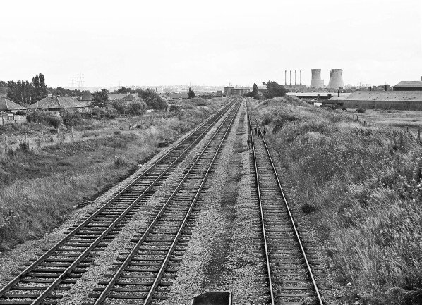
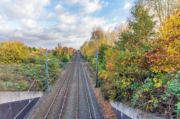
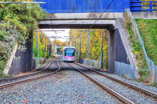
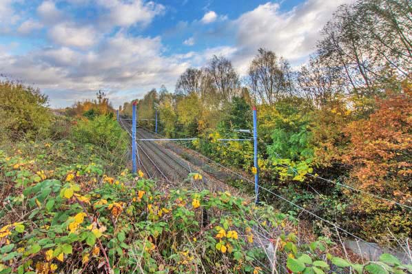
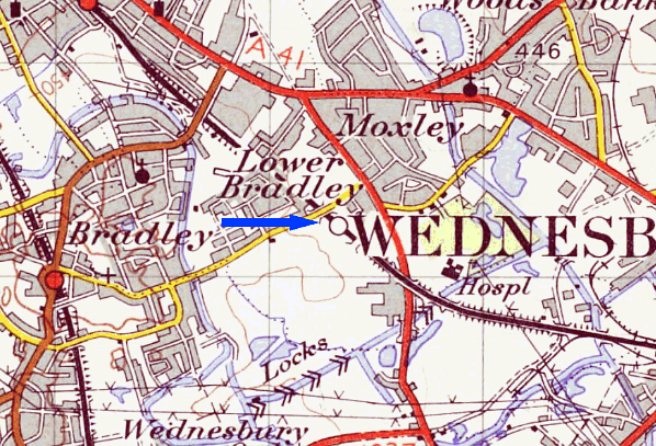
Today very little evidence of a station existing remains, however, at certain times of year, the platform access ramp from Bradley Lane to the Birmingham bound platform is discrenable. A new tram stop called Bradley Lane is now situated to the north-west of the lane bearing the same name.
Route map by Alan Young.
Sources:
- Bradshaw's Railway Guide December 1895 - Middleton Press
- Forgotten Railways: Volume 10, The West Midlands - Rex Christinsen - David & Charles Publishing 1985
- A Regional History of the Railways of Great Britain - Volume 7 The West Midlands - Rex Christiansen - David St John Thomas Publisher 1991
- A Century of Railways around Birmingham and the West Midlands Vol 1,2 & 3 - John Boynton - Mid England Books Publisher 1999
- From Main Line To Metro - John Boynton - Mid England Books 2001
-
|
To see the
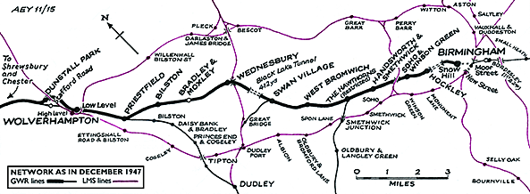
other stations on the Birmingham Snow Hill - Chester General line
click on the station name: Birmingham Snow Hill, Hockley, Winson Green,
Handsworth, The Hawthorns, West Bromwich, Swan Village,
Wednesbury, Bilston, Priestfield, Wolverhampton Low Level, Dunstall Park, Stafford Road, New Hadley Halt, Admaston Halt, Walcot, Upton Magna, Abbey Foregate, Shrewsbury S&C,
Leaton, Oldwoods Halt, Baschurch, Stanwardine Halt, Haughton Halt,
Rednal & West Felton, Whittington Low Level, Weston Rhyn, Whitehurst Halt, Rhosymedre, Rhosymedre Halt, Wynville Halt, Rhos, Johnstown & Hafod, Rhosrobin Halt, Gresford, Rossett, Pulford, Balderton and Saltney
|
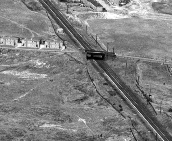
The station site seen from the air in 1949 looking in the Wolverhampton direction.
Photo from Britain from Above reproduced under the terms of their non-commercial licence
 Home Page Home Page
| Last
updated: Sunday, 04-Jun-2017 09:55:56 CEST | ©
1998-2017 Disused Stations | |
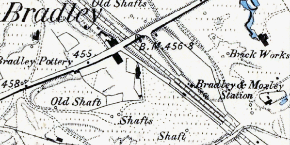
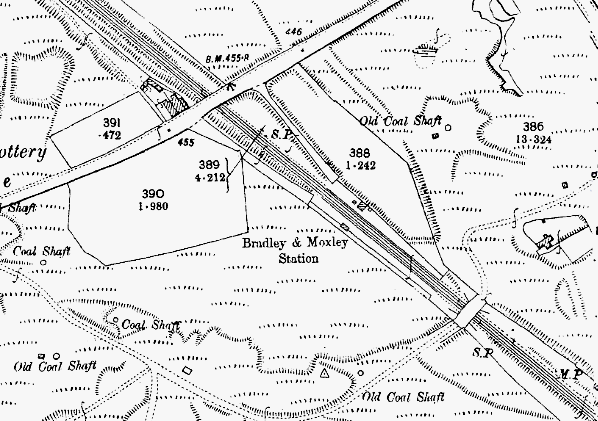 The 1903 1:2500 OS map gives a good indication as to how remote the station was from the settlements from which it took its name.