 Station Name: YARMOUTH SOUTH TOWN
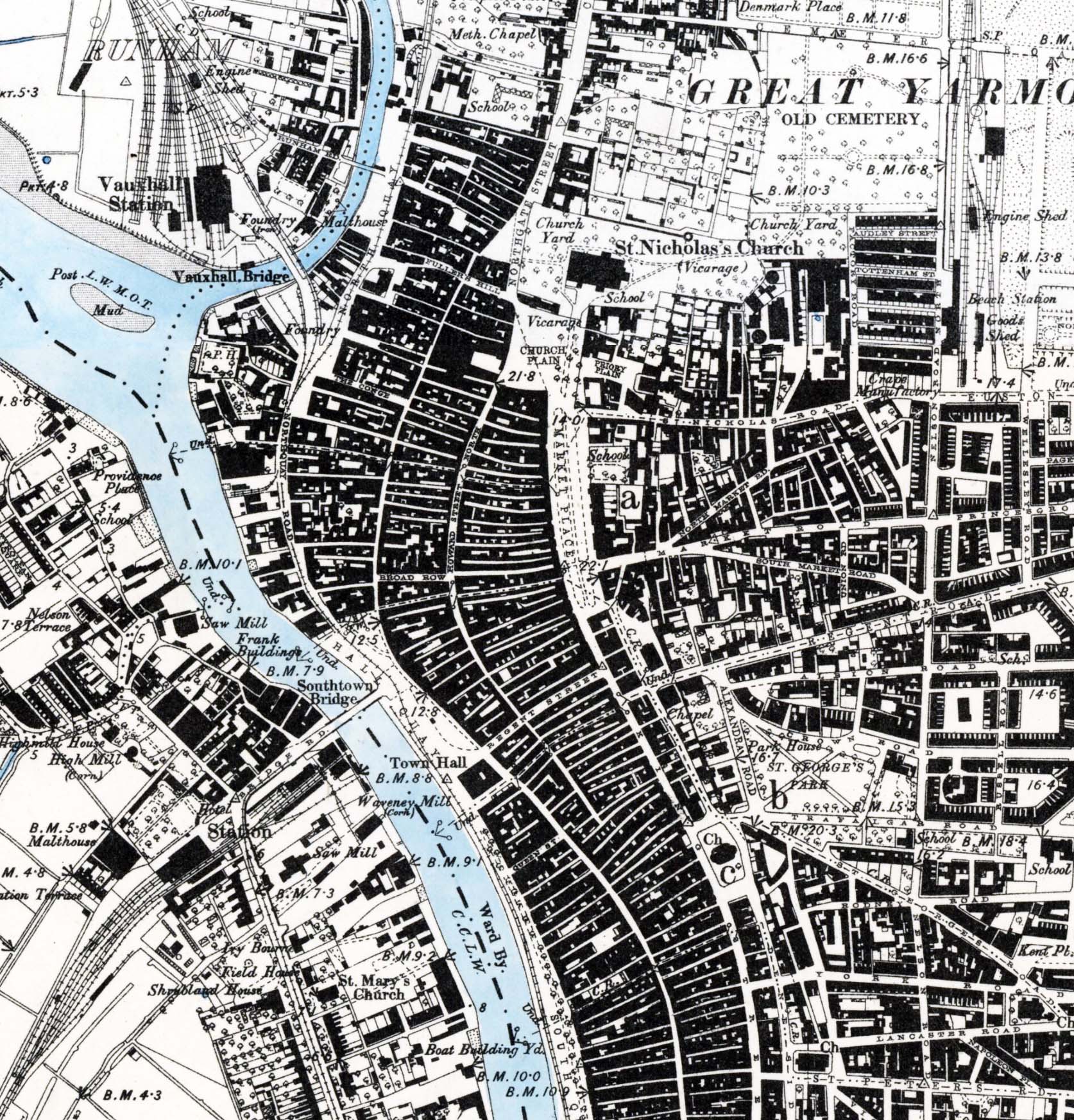 1886 1:10, 560 OS Map. Although a little hard on the eyes, this map shows the positions of Yarmouth's three terminal stations relative to each other; Beach at top right; Vauxhall at top left; South Town at bottom left. Also visible is the quayside tramway with its connection to Vauxhall and part of the line connecting to the M&GN Beach station. When the link over Breydon Viaduct was in use it was possible to reach the quayside tramway from all three terminal stations, albeit with reversals and limitations on motive power permitted on the tramway. On Bridge Road and Southtown Road the street tramway from Gorleston is marked as a single track with a passing loop near South Town station. It was still a horse tramway at this time. The railway track leading to South Town goods yard is shown as being single. This is believed correct for this date. Shown running into the passenger station are two running lines plus one siding which appears to end at the trainshed without entering it. Either way, the two running lines concur with the original Arrivals and Departures platforms layout. Just west of the station the Malthouse (referred to in the text as The Maltings) is yet to have a rail connection. To the northwest of the station stands High Mill, said to have been the tallest brick-built mill in the country
 Home Page Home Page
|