| Station Name: WESTERHAM |
 |
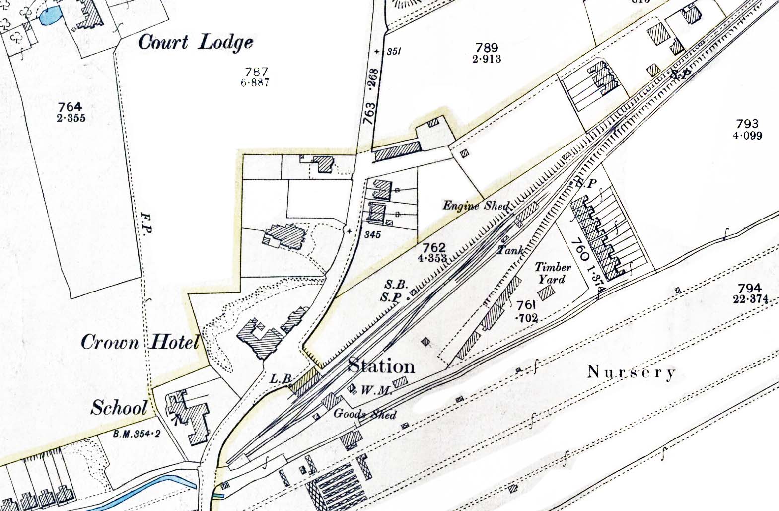
1895 1:2,500 OS map shows the railway as built. The station forecourt is seen opposite the Crown Hotel. LB indicates a letterbox. The short platform is shown with the signal box and signal at the north end. The main line continues south-west to terminate beside the station's unusually small cattle dock. A run-round loop is seen opposite the station building. At this time there is only one goods siding which passes though the goods shed opposite the station building to terminate end-on to the dock. Between the shed and the dock there is a crossover which joins the siding with the run-round loop. A trailing junction on the siding leads to the engine shed with the water tank named beside the shed road. Horton's timber yard is seen to the south of the station with Horton's Cottages (later Railway Terrace) to the east of the yard. A weighbridge and office (WM = weighing machine) is seen just inside the entrance to the goods yard. Madan Road is seen running east from London Road to the north of the line with a terrace of houses at right angles to the road. Two further signal posts are shown, one top right on the approach to the station and the 'shunt' signal alongside the siding.
 Home Page Home Page
| Last
updated: Friday, 26-May-2017 09:57:11 CEST | ©
1998-2016 Disused Stations | |
