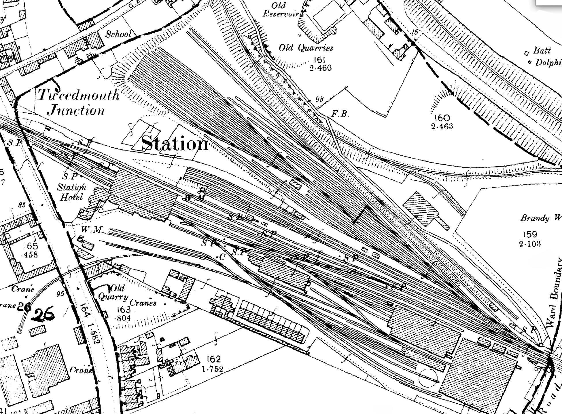
Station Name: TWEEDMOUTH1866 1:2,500 OS map. The railway facilities at Tweedmouth have been considerably expanded by the North Eastern Railway. The passenger station itself is much as it was in 1855, with the trainshed still in place, but with ‘Station Hotel’ now named. The NER has added the large loco shed adjacent to Billendean Road at the south-eastern end of the station site but retained the original shed. Further sidings have been constructed into the station forecourt, one extending across the main road into the saw mill. The weigh office (‘WM’ – weighing machine) is shown in the coal yard / forecourt. The station’s goods facilities are now concentrated on the up (north-east) side of the station with its vast expanse of sidings. A group of six sidings serves what was identified on the 1866 map as the coal depôt; the weigh office is shown in its 1866 position, but the coal drops are no longer indicated. The original goods warehouse (not named) on the opposite side of the main line is still in use, and a new warehouse to serve the up side goods facilities would be built in 1902-03. A branch from the goods yard leads (via a reversal) to Tweed Dock. The warehouse shown south of the passenger station on the 1866 map has gone, but a pair of semidetached houses has been built on its site, presumably for senior railway staff, adjoining the
terrace of enginemen’s cottages.  Home Page Home Page
|