Station Name: THORNTON-IN-CRAVEN
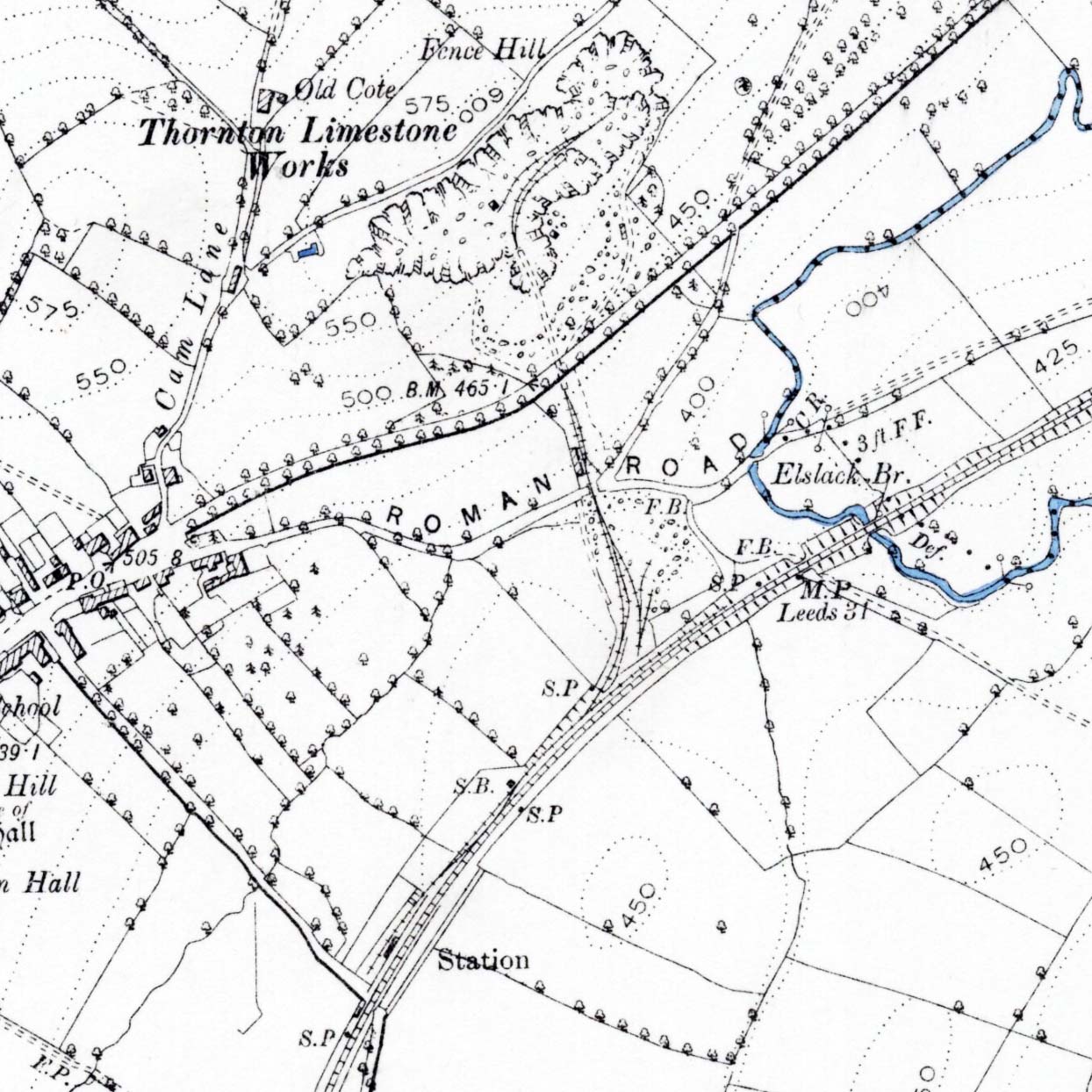
1894 1: 10,560 OS map.Thornton-in-Craven village, railway station and quarry are shown on this map. The station is about ¼-mile from the village, reached by a lane without any housing development. At this date the map indicates that the only building at the station is on the up (north-west, Skipton-bound) platform; the station house would soon be added. The signal box (SB) and signal posts (SP) are shown as is a siding behind the up platform. The quarry, named ‘Thornton Limestone Works’ is reached by a siding from the Skipton-Colne line which passes over the ‘Roman Road’, the old road to Skipton, before tunnelling under the present-day route to emerge at the southernmost extent of the quarry. Sidings for stone traffic branch from the line into the quarry.
| Last
updated: Friday, 26-May-2017 08:55:03 CEST |
© 1998-2017 Disused Stations
| |


 Home Page