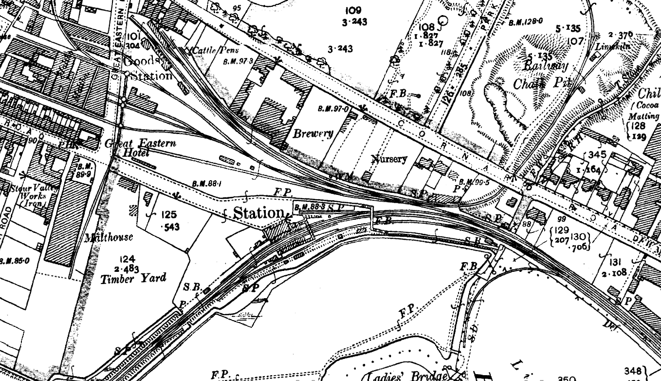
1904 1:2,500 OS map shows the layout of the station. The original terminus is at the top of the map; this became the town's goods station when the line was extended to Cambridge in 1865. The cattle dock and pens are seen opposite the old terminus building. Numerous sidings serve the malthouses on the west side of Great Eastern Road. Each has a small wagon turntable for moving wagons between sidings. A reversal from the line into the goods yard gives access to a short siding serving a railway owned chalk pit seen top right. An additional goods dock is seen running behind the up platform. Two signal boxes are shown, one at either end of the station. The station box is on the up side to the south-west of the station and the Sudbury Goods box is on the down side to the east of the station. Click here for a larger version of this map

 Home
Page
Home
Page