
 |
 |
[Source:
Nick Catford]
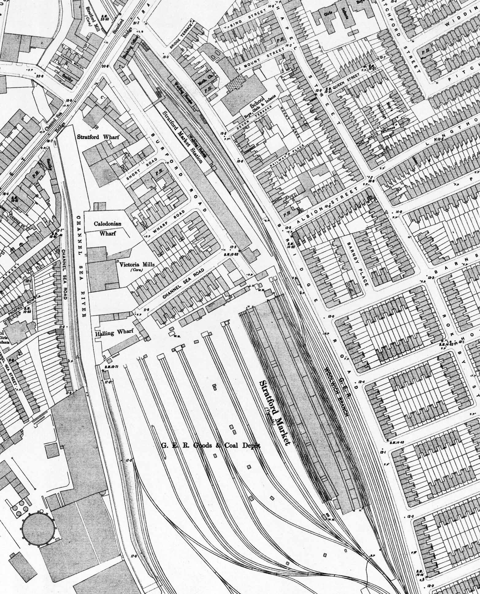 1895 1:1056 OS Town Plan. This map shows Stratford Market station after rebuilding in 1892 but before the goods lines were laid. The street level building houses only the booking office, the other buildings to the south were constructed at the same time as retail outlets; at least two were coal merchants' offices. The staggered platforms are clearly seen, the up (west) platform stopping 50ft short of the High Street bridge. There are stairs to the down (east) platform from the booking office but because of the platform stagger the up platform is reached by a ramp leading to a flight of steps. At the bottom of these steps there is a second entrance from Burford Road. A path from Burford Road crosses over the, as yet, un-laid goods lines to reach another set of steps down to the platform. Further south along the up platform there is a second bridge over the goods lines giving direct access from the platform to the GER print works which is the long building on the east side of Burford Road. The two blocks of waiting rooms, which are also staggered, are shown on the platforms. To the south of the down platform waiting room an entrance onto Bridge Road is shown. Stratford Fruit and Vegetable Market is seen on the up side to the south of the station. The internal layout of the building is clearly shown with a wide central roadway with platforms either side. The individual tenants' warehouses are also shown with the two covered sidings running alongside the warehouses. 12 sidings are seen to the west of the market laid in pairs. Four cart-ways, varying from 40 to 70 feet in width run between the sidings; these allow carts can back up against 200 trucks at one time. Some trailing sidings are seen to the west, two running alongside the Channelsea River. These serve the West Ham Gas Works on the opposite bank of the river; an aerial cable way can be seen crossing the river at the bottom of the map. Another trailing siding to east of the Gas Works siding served the Victoria Stone Works which is off the map at the bottom. A signal box (SB) is shown at the north end of the market on the down side of the main line. The entrance to the market and goods yard is at the end of Burford Road with a weighbridge (WM) just inside the entrance and another to the west.
 Home Page Home Page
| Last
updated: Friday, 26-May-2017 11:05:01 CEST |
© 1998-2016 Disused Stations
| |