[Source: Nick Catford] 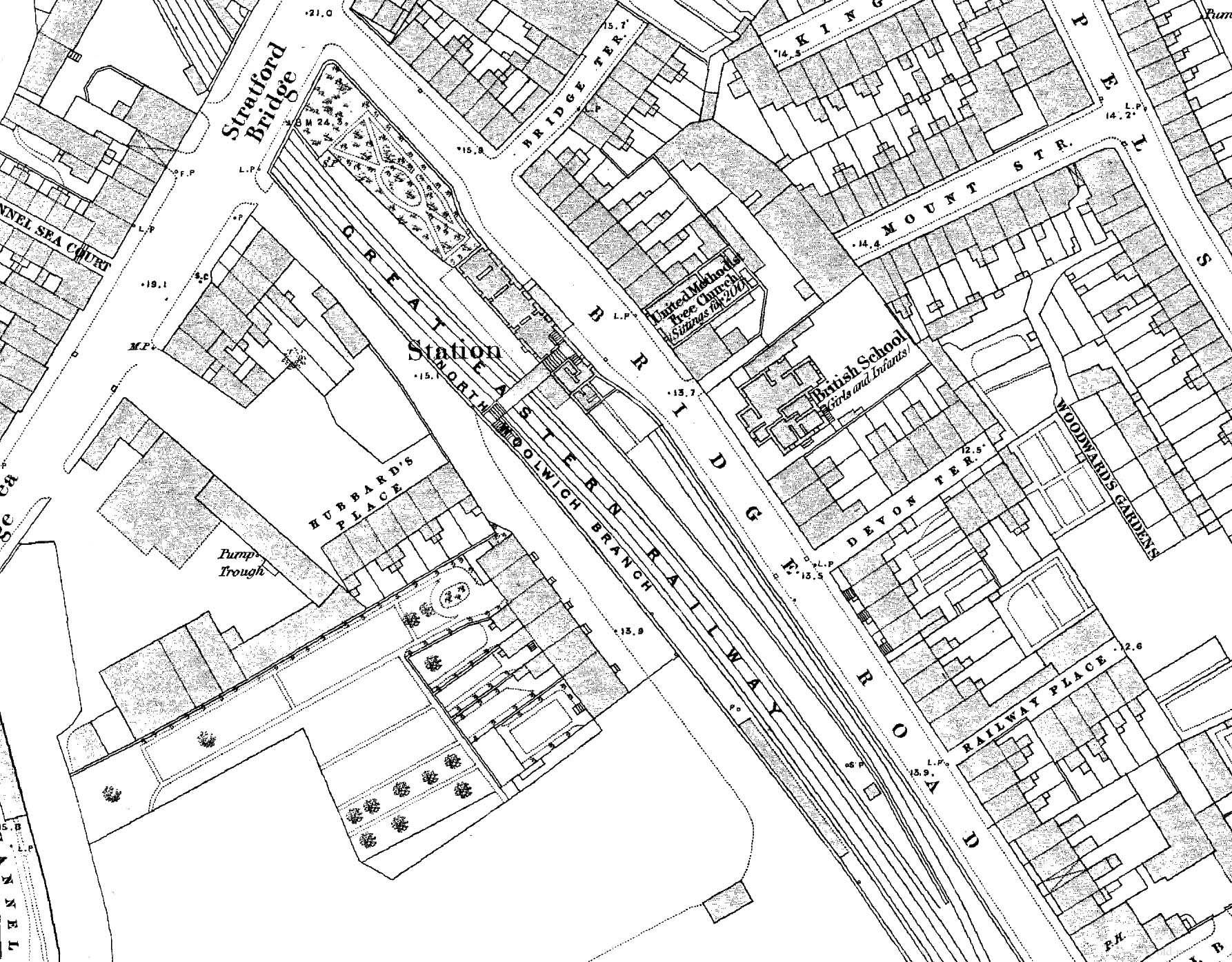 1868 1:1056 OS Town Plan. This map shows the layout of the station as built. The main station building fronts onto Bridge Road with the road widening to form a narrow forecourt. There is a short canopy in front of the entrance. The building opposite on the corner, adjacent to the United Methodist Free Church is the Railway Tavern pub and is ideally sited for the use of passengers. The room layout of the station building is clearly shown. An elaborate footbridge spans the platforms with one end inside the station building. Two facing flights of stairs lead up to a landing from where another flight at right angles leads up to the bridge. A canopy is shown over the platform stretching the full length of the building. What appears to be a gents' toilet is sited at the south end. There doesn't appear to be any kind of waiting room or shelter on the opposite (up) platform although there is a long building towards the south end. A siding runs behind the south end of the down platform up to the station building
. 1868 1:1056 OS Town Plan. This map shows the layout of the station as built. The main station building fronts onto Bridge Road with the road widening to form a narrow forecourt. There is a short canopy in front of the entrance. The building opposite on the corner, adjacent to the United Methodist Free Church is the Railway Tavern pub and is ideally sited for the use of passengers. The room layout of the station building is clearly shown. An elaborate footbridge spans the platforms with one end inside the station building. Two facing flights of stairs lead up to a landing from where another flight at right angles leads up to the bridge. A canopy is shown over the platform stretching the full length of the building. What appears to be a gents' toilet is sited at the south end. There doesn't appear to be any kind of waiting room or shelter on the opposite (up) platform although there is a long building towards the south end. A siding runs behind the south end of the down platform up to the station building
. Home Page Home Page
|