
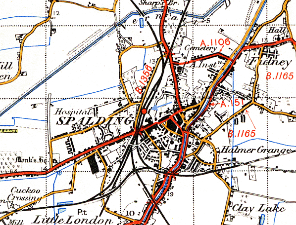
Station Name: SPALDING
|
| Date opened: | 17.10.1848 |
| Location: | West side of Kings Road (A151) |
| Company on opening: | Great Northern Railway |
| Date closed to passengers: | Still open |
| Date closed completely: | Still open |
| Company on closing: | Still open |
| Present state: | Today Spalding station is a shadow of its former self. The site of the goods yard is now occupied by a busy road which now passes the front of the station. The majority of the buildings on Platform 1 are still there and still look majestic. Platform two has a fence down the middle of it to separate it from its derelict face (Platform 5) which is now overgrown and inaccessible. Platform 2 has a basic open fronted waiting shelter. The original footbridge still spans the two platforms although it is no longer covered. The skeletal framework of the bridge now devoid of decking and steps crosses the derelict trackbed between Platforms 5 & 6 but the arch in the brick tower has been bricked up to prevent access. The west island platform (6 & 7) has been demolished and replaced by a new housing development . (Jubilee Close and Truro Way) |
| County: | Lincolnshire |
| OS Grid Ref: | TF243228 |
| Date of visit: | 7.1.2010 |
Notes: A settlement has existed at Spalding as far back as Roman times when the area was used for the production of salt and navigation of the River Welland dates back to this time. Navigation was improved by the construction of the Stamford Canal between Stamford and Market Deeping which was in use by the 1660s, 100 years before the 'canal age' took hold. The Welland Navigation actually went on further than Market Deeping, passing through Crowland and ending at Spalding. As a result of these navigation works
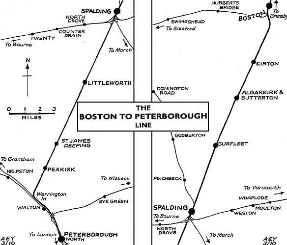
The GNR subsequently added a line eastwards to Sutton Bridge via Holbeach (the Norwich & Spalding Railway) in stages between 1858 and 1862, a westward route to Bourne in 1866 and another to March the following year in an attempt to thwart the ambitions of the competing Great Eastern Railway (GER). These efforts didn't succeed however and the company eventually agreed to work these routes jointly with the Midland Railway (the former pair forming the backbone of the Midland and Great Northern Joint Railway system) and the GER (March line) by the beginning of the 1870s. The collaboration between GNR and GER also led to the construction of the last route out of the town, the GE&GN Joint line to Sleaford which opened to traffic on 1 August 1882. By the end of the nineteenth century the town had become a major rail crossroads and the station had grown to reflect this, having more than doubled in size from its opening half a century earlier. It
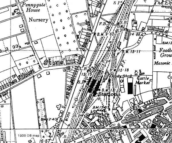
Spalding station was designed by John Taylor, opening with the loop line on 2nd October 1848; initially the station had two facing platforms. The main station buildings were on the up platform and included a booking office and three storey station master's house, similar in style to others on the loop line. The station was substantially rebuilt and resignalled during the construction of the GN & GE Joint line and in its final form had five through platform faces and a bay comprising the original main line down platform and two wide island platforms with a bay set into the north end of the middle platform. A covered footbridge spanned all the platforms. Platform 1 was the original down platform, the through faces of the middle island platform were Platforms 2 & 5, the two faces of the bay were Platforms 3 & 4 and the west island platform was Platforms 6 & 7. Althouugh never officially named Spalding Town this name was often used in timetables, on tickets and on signs.
One of the major products handed at the station was tulips; At its peak in 1939 10,000 acres were turned over to growing bulbs locally. In the 1930s the Spalding bulb industry moved 3,000 tons of flowers in 375,000 boxes with 12 to 18 bunches in each box from Spalding Station each year. The Spalding annual flower parade began in 1959 and British Railways exploited its potential by running excursions to the event from many parts of the country for many years. A sugar beet factory opened in 1926, access to its sidings being just north of Spalding station. These sidings were also used by Van Geests for the storage of bananas. A 2-road brick engine shed was opened by the Midland & Eastern Railway on 1st August 1866. Although the shed was built by the Midland the GNR shared it from 1868 and the depot became M&GNR property around 1895. It came into BR as a sub-shed of New England (35A), becoming sub to Boston (40F) in February 1958 and closed on 7th March 1960.
For further pictures of Spalding station see the Lancashire & East Yorkshire Transport Review web site. Additional source: Wikipedia, text reproduced under creative commons licence..
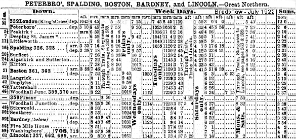
On 1 March 1848 the East Lincolnshire Railway opened its line between Louth and Grimsby which although nominally independent, was leased to the GNR from the start. This line was extended south to Boston on 1st October 1848. The loop line opened between Werrington Junction and Lincoln via Boston on 17th October 1848, with GNR trains using the Midland line from Werrington Junction into Peterborough. The line between Boston and Lincoln was often referred to locally as the Witham Loop as it followed the course of the River Witham.
For a brief period this was the main route to the north and Scotland and early traffic exceeded expectations with five daily trains and two on Sundays; but with the opening of the main line from Peterborough to Doncaster via Grantham and Newark in 1850 the loop line settled down to a quieter existence attracting only local traffic. Intermediate stations opened on the same day at Peakirk, Littleworth, Spalding, Algakirk & Sutterton, Langrick, Tattershall, Kirkstead, Bardney & Wragby, Five Mile House & Washingborough. Within two years further stations were added at St. James Deeping, Surfleet, Kirton & Dogdyke.
It became clear that the area would be better served by a railway from Horncastle to the Loop Line. Without a railway it was feared the town would decline as competition increased from the fairs and markets of other towns served by a railway. In 1853 the Horncastle Railway Company was formed to build a single line from the Loop Line at Kirkstead to Horncastle. Having received their Act, construction began in March 1855 and the line opened on 11th August 1855. A new line linking Louth with Lincoln was first proposed on 3rd November 1865. The proposed route would leave the ELR at Louth terminating at a junction with the Loop Line east of Five Mile House station. The Louth and Lincoln Railway Company was incorporated on 6th August that year but within a few months it was clear the company would be unable to purchase the land for the proposed junction with the GNR.With local funding also proving difficult to raise a shorter revised route was proposed joining the Loop Line at Bardney where all trains would run into a bay platform from the wrong direction, access to the main line requiring the use of cross-overs. The line opened for freight traffic between Bardney and South Willingham on 9th November 1874, this was extended to Donington-on-Bain on 27th September 1875 and finally through to Louth on 26th June 1876.
On 16th September 1887 the Lincoln, Horncastle, Spilsby & East Coast Railway (HS&ECR) receive authority to build a line from Stixwould on the Loop Line. On this occasion the GNR didn't appose the Bill agreeing to work the line for 60 per cent of the receipts. The company was unable to raise sufficient capital and the GNR declined an offer to take over the powers when the scheme was abandoned in 1891. There were no further proposals for a northern route into Skegness until 1910 when Skegness Town Council approached the GNR asking for better service to the resort from Manchester, Birmingham and Leeds. It suggested a line linking the Spilsby & Horncastle branches stating that if the GNR was not sympathetic they would seek help from the Midland Railway. An alternative scheme was also suggested with a new line being built from Kirkstead on the Loop Line to Little Steeping on the ELR. The GNR Board approved the latter scheme and a light railway order was granted on 18th July 1911. Although the new railway’s official title was ‘The Kirkstead and Little Steeping Railway’ it was universally known as the ‘New Line’. Construction of the 15-mile double track line started at both ends in March 1912. The line left the Loop Line at Coningsby junction 1 1/2 miles south of Kirkstead station, joining the ELR at Beliwater Junction, between Eastville and Little Steeping. The new line opened for goods on 1st June and passengers on 1st July, 1913.
In 1922 Kirkstead was renamed Woodhall Junction in an attempt to increase the profile of nearby Woodhall Spa as a holiday destination. Some north Lincolnshire branch lines lost their service before the Beeching Axe fell. The Horncastle line closed to passengers on 13th September 1954 although it remained open for goods traffic until April 1971. The intermediate stations between Peterborough and Spalding and Spalding and Boston closed on 11th September 1961. The section of the Loop Line between Woodhall Junction and Boston was closed to passengers and goods on 17th June 1963 because traffic levels didn't justify the required expenditure on the track and signalling that was required to keep the line in use leaving a service from Lincoln over the loop line to Coningsby Junction and then via the 'New Line' to Firsby. Coningsby became the railhead for the area previously covered by Tattershall & Dogdyke and some trains from Lincoln terminated there. British Railways also suggested the closure of the Lincoln to Skegness line to take effect from 6th June, 1964. This would have seen the closure of the New Line as well as the northern section of the Lincoln to Boston line. With the Grimsby to Boston line also under threat the biggest local enquiry held by the Transport Users’ Consultative Committee took place in Skegness on 15th and 16th September, 1964 to hear objections to the proposals.
The Minister accepted that passengers travelling on the Coningsby-Lincoln section of the line would suffer inconvenience amounting almost to hardship if this section were closed but he also noted that the numbers concerned were small and he didn't consider that he would be justified in asking the Board to retain this particular service. Closure of the Lincoln - Firsby line was announced for 5th October 1970 with the last train running on Saturday 3rd October 1970. On the same date the service was also withdrawn from the southern end of the loop line between Peterborough and Boston although all the intermediate stations were already closed. Boston and Spalding remained open as they could be reached by other routes. The line between Spalding and Peterborough reopened with a limited (peak hours only) passenger service on 7 June 1971. Freight trains continued to operate to Horncastle, via Woodhall Junction until 5th April 1971, when Bardney became the terminus of the line. The line between Lincoln & Bardney remained open for freight traffic serving the sugar beet factory adjacent to Bardney station. This traffic ceased in January 1981 by which date there were very few trains which ran 'as required' on Monday, Wednesday and Friday during the beet season (March - September); The last passenger train, a DMU railtour, ran into Bardney on 21st January 1981. The station site was sold to British Sugar in 1982 and all the track was lifted within a year.
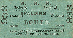
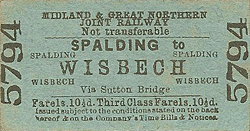
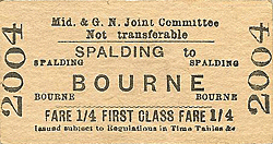
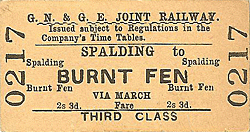
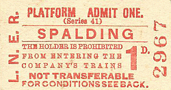
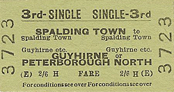
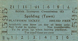
Tickets from Michael Stewart, route map drawn by Alan Young To see other stations on the Lincolnshire Loop Line between |
old2.jpg)
old1.jpg)
13.jpg)
32.jpg)
store is seen on the left.
27.jpg)
33.jpg)
Photo by Adam Cartwright from Lincolnshire Railways from the past web site.
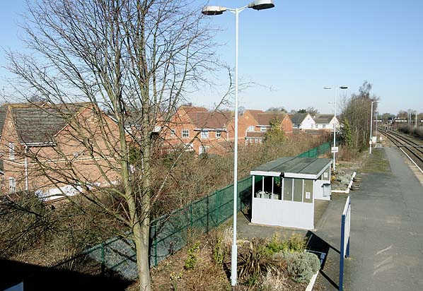
Photo by Nick Catford

 Home Page
| Last updated: Friday, 26-May-2017 11:00:10 CEST |
© 1998-2010 Disused Stations
|