Station Name: SOUTHCOATES
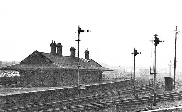
Southcoates
station with its island platform.
Photo received from Nicholas Cox  
1893 1:2,500 OS map shows the layout of the station. There is an island platform with a waiting room. Access is along a footpath along the west side of the line. The building to the west of the line close to the road is assumed to be the booking office.
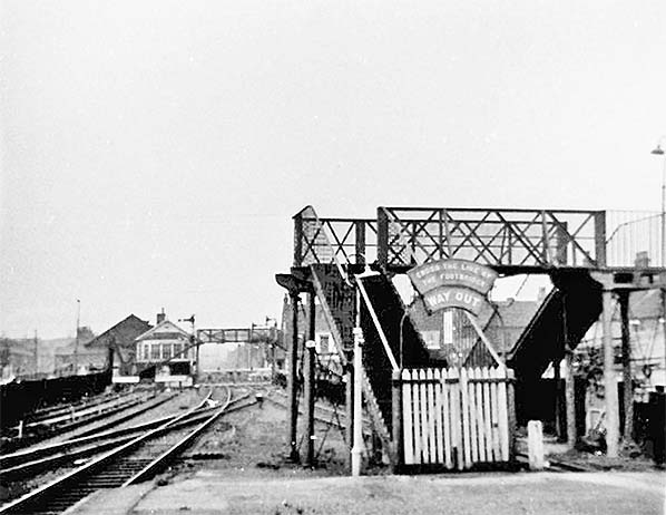
Looking north west from the end of the platform towards the signal box at the crossing c1965. The footbridge seen here is smaller than the bridge shown on the map above. Access to the station is now along a footpath on the east side of the line. The building identified as a possible booking office on the map has been demolished and its site is occupied by a coal depot. By this date the station was unstaffed. The end of the platform has also been slightly shortened.
Photo by Keith Easton 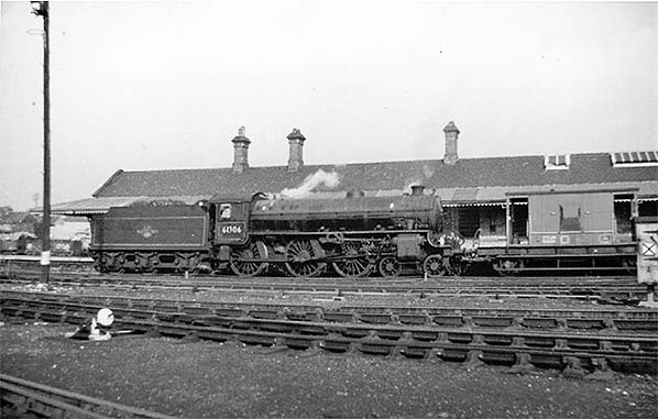 Shunting at Southcoates station c1965. The station closed to passenger traffic the previous year but would remain open for goods traffic until 1969.
Photo by Keith Easton 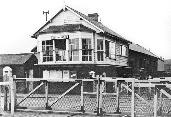
The
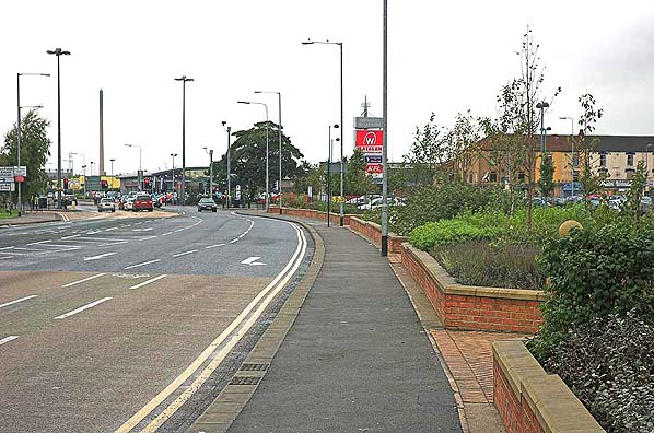
site of Southcoates station looking north in October 2005. In the
shot looking north, the railway trackbed ran approximately through
the traffic lights (the site of the level crossing on Holderness Road)
and the new road north
Photo by Mark Dyson 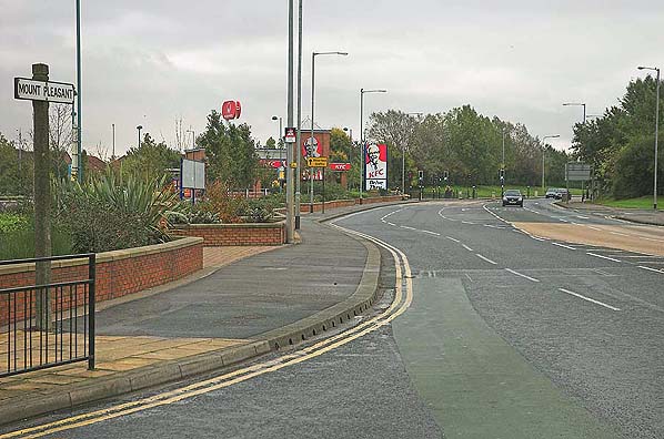
 Home Page Home Page
|
 Notes: The station originally opened on 1.6.1853 but was short
lived closing in November 1854. The station was resited and reopened
ten years later in June 1864. Southcoates station was served by
Withernsea trains and had an island platform accessed from a footbridge
on the east side of the tracks, with a network of sidings on the
west side of the station. Goods services were withdrawn from Souhcoates
from 16.10.1905 and the station was unstaffed from 4.1.1960.
Notes: The station originally opened on 1.6.1853 but was short
lived closing in November 1854. The station was resited and reopened
ten years later in June 1864. Southcoates station was served by
Withernsea trains and had an island platform accessed from a footbridge
on the east side of the tracks, with a network of sidings on the
west side of the station. Goods services were withdrawn from Souhcoates
from 16.10.1905 and the station was unstaffed from 4.1.1960. The Victoria Dock branch line was just over 3 miles long, running
in a rough semicircle from Anlaby Road (junction with the Hull-Selby
line) to the north of Hull and terminating at the dock; powers
were obtained in June 1852 and the line opened for freight on
16.5.1853. The line was built at ground level, and there were
level crossings on all of Hull's main roads. A suburban passenger
service, one of the earliest in the country, began on 1.6.1853,
it lasted only until 1854 due to lack of passenger numbers.
The Victoria Dock branch line was just over 3 miles long, running
in a rough semicircle from Anlaby Road (junction with the Hull-Selby
line) to the north of Hull and terminating at the dock; powers
were obtained in June 1852 and the line opened for freight on
16.5.1853. The line was built at ground level, and there were
level crossings on all of Hull's main roads. A suburban passenger
service, one of the earliest in the country, began on 1.6.1853,
it lasted only until 1854 due to lack of passenger numbers. With closure of the Hornsea and Withernsea routes in October
1964, the Victoria Dock branch stations closed, through freight
services to and from the docks continued to use the line until
its complete closure in 1968.
With closure of the Hornsea and Withernsea routes in October
1964, the Victoria Dock branch stations closed, through freight
services to and from the docks continued to use the line until
its complete closure in 1968.