
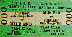
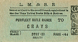
Station Name: PURFLEET RIFLE RANGE[Source: Nick Catford]
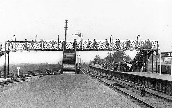 Purfleet Rifle Range, known variously as a station or a halt, looking towards Rainham and Fenchurch Street. Impressions are that troops have just disembarked from a Down train but it is possible the scene was deliberately posed soon after the station opened and the latter may be borne out by the spotless running-in board on the right. Note there was another such board further along the platform; there was probably a third closer to the signal box and level crossing behind the camera. The soldiers crossing the footbridge are carrying their rifles which would have been the famous Lee-Enfield and either the .22 training version or most likely one of the .303 SMLE variants. In the left background can just be discerned one of the numbered firing targets, all of which were located on the west side of the site. On the right sits a Great Eastern Railway open wagon, there being basic goods facilities on this side of the station. The platform face on the left never had, as far as is known, a track serving it. The track at extreme left curved away into the rifle range. There was a runround loop, one set of points for which can just be discerned, but otherwise the spur was single track. It ended at a transfer shed which, by scaling aerial photographs, measured 160ft x 100ft. Some maps imply the standard gauge spur entered this shed but this was not the case, at least not in later years, it actually ended alongside the shed where an unloading dock of some form would have been provided. The internal narrow gauge system did, however, enter the shed and what few scant details are known of the narrow gauge system
are given elsewhere. Photo from John Mann collection 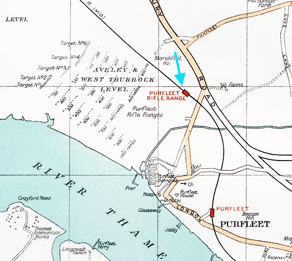 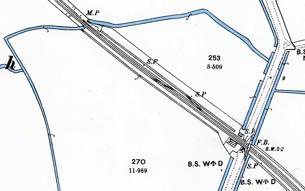
1897 1:2,500 OS map shows the site before the station was built A siding already existed, this was usually known as Purfleet Siding but also known as Ordnance Crossing Siding. A signal box and crossing keepers cottage are seen on the west sid of the crossing with a footbridge on the east side.
.gif)
1947 1:2,500 OS map. The staggered platforms of Purfleet Rifle Range station are clearly seen as is the shelter on the island platform. There is a footbridge at the level crossing and another wider footbridge at the north end of the up platform spanning the platforms and the spur into the cordite store. Steps are seen down to each platform and a thirds stairway gives access to the rifle range. The building close to the steps probably includes a ticket office. A standard gauge spur with a passing loop curves round to enter the cordite store. A narrow gauge line from the store runs south towards the River Thames. It passes the eight magazines of the WW2 EAM, each magazine having rail access. On the approach to the five gunpowder magazines the line splits, one line serving the magazine while the other runs onto a jetty on the River Thames. A branch from this lines also runs along a riverside quay with a travelling crane. Click here for a larger version.
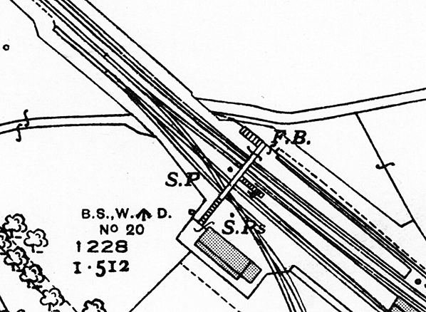 1947 1:2,500 OS map. Close up view of the track arrangement for the spur into the cordite store.
 1960 2½" OS map. 1960 2½" OS map.rifle_range_old2.jpg)
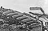
Purfleet Rifle Range station in 1950, two years after closure to passenger traffic. The station remained intact at this time, the shelter is clearly seen on the up platform. Immediately west of the station a standard gauge spur curves round to the cordite store which is surrounded by earth banks for blast protection. A narrow gauge line comes out of the cordite store passing eight WW2 anti-aircraft ammunition magazines (EAM). A spur from this line is seen entering the EAM at its south end. The land top left is part of Purfleet Rifle Range. Click here for a larger version.
Photo from Britain From Above reproduced with permission rifle_range_old3.jpg)
Purfleet Rifle Range station in July 1952, some four years after closure. The deterioration is obvious and indicative of the basic means by which the station was constructed. It was nevertheless quite expansive and as can be seen had staggered platforms. This layout was dictated by the access point into the rifle range and the location of the level crossing, behind the camera. Some debate exists regarding whether a halt or a station. Railway tickets were issued from Purfleet Rifle Range and given that trains serving it were suburban in nature, ie of non corridor stock, tickets must have been issued from an office on site and probably located in the building seen in the left background. The fact tickets were issued on location technically makes it a station rather than a halt but nevertheless surviving, cast, WD signs, of which at least two survive, bear the title 'PURFLEET RIFLERANGE HALT'. On the left an LMS style nameboard still stands while on the right coal merchants are unloading coal in the modest goods facility. Their lorry appears, of course, to be a Bedford and possibly an M Type. At far left some wagons sit on the spur into the rifle range, or perhaps on the runround loop. In the distance is a short goods train and a member of staff going about his duties. No doubt some shunting is ongoing or has just been completed. As mentioned previously, behind the camera was Tank Hill Road level crossing and the signal box.
Copyright photo from Stations UK 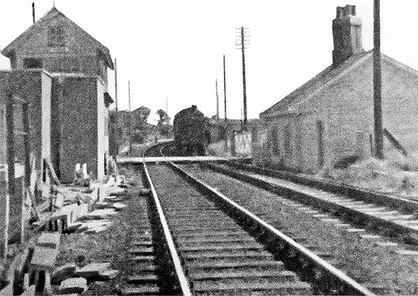 An unknown train approaching Purfleet Rifle Range c1950s. Rifle Range signal box and the crossing keepers cottage are seen. Both have now been demolished.
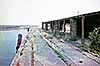
Photo from the Purfleet Heritage and Military Centre range1.jpg) One of 8 rail served WW2 anti-aircraft magazines south west of Purfleet Rifle range station in March 1997. A standard gauge siding ran from immediately north of the station on the up side (see map above) into a blast protected exchange shed. From the shed a narrow gauge line originally served five 1759 gunpowder magazines close to the River Thames. When the anti-aircraft magazines were built they were linked to the narrow gauge line. The concrete blocks in front of each entrance are loading docks. One of 8 rail served WW2 anti-aircraft magazines south west of Purfleet Rifle range station in March 1997. A standard gauge siding ran from immediately north of the station on the up side (see map above) into a blast protected exchange shed. From the shed a narrow gauge line originally served five 1759 gunpowder magazines close to the River Thames. When the anti-aircraft magazines were built they were linked to the narrow gauge line. The concrete blocks in front of each entrance are loading docks.Photo
by Nick Catford
range2,jpg.jpg)
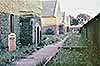
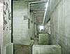
This view, facing due south, shows what is thought to be the sole remaining section of the range's former narrow gauge internal system in March 1997. The bridge is a typical military concrete structure while the stanchions for the railings are not, as it may appear, made from old rails but from sections of what we now call RSJ (Rolled Steel Joist) On its way to the jetty, the narrow gauge line twice crossed the meandering Mar Dyke; once near the transfer shed and again on the approach to the jetty. The bridge seen here is that near the transfer shed, which stood a short distance to the photographer's right. The line in this area was on a lengthy curve, hence the transfer shed being to the right, with the only straight section within this curve being that seen here on the bridge. With careful examination of the photograph it can be seen that the track at the far end of the bridge recommences its curve to the right. The bridge and embedded track still survive within the RSPB reserve
Photo by Nick Catford range1.jpg)
The site of Purfleet Rifle Rand in September 1999 during work to realign Tank Road to the west. The halt was immediately west of the level crossing. The new road alignment crosses the east end of the halt site. The site of Purfleet Rifle Range signal box is now occupied by a white cabin to the west of the crossing, the box box closed in 1980, and the control of the level crossing was transferred to Purfleet box.
range3.jpg) One of two surviving War Department cast iron station signs is displayed on one of the buildings in the RSPB reserve the occupies the rifle range. (May 2018).
Photo by Phil Mann range4.jpg) An identical sign is on display in the Purfleet Heritage and Military Centre with is located in No 5 gunpowder magazine. An identical sign is on display in the Purfleet Heritage and Military Centre with is located in No 5 gunpowder magazine.Photo
by Nick Catford
range5.jpg) The former Tank Hill Road level crossing seen from the New Tank Hill Road bridge in June 2018. The crossing was abolished in 1999. Purfleet Rifle Range station's up platform was immediately west of the crossing; the platforms were staggered. The former Tank Hill Road level crossing seen from the New Tank Hill Road bridge in June 2018. The crossing was abolished in 1999. Purfleet Rifle Range station's up platform was immediately west of the crossing; the platforms were staggered.Photo by Nick Catford range6.jpg)
Looking west at the site of Purfleet Rifle Range station seen from New Tank Hill Road bridge
in June 2018. Photo by Nick Catford
|
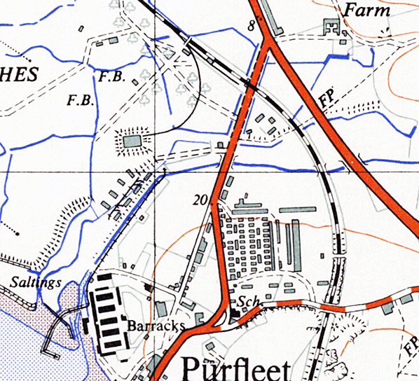
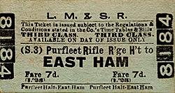
 A railway between London and Southend was authorised in 1852 and the first section was opened in 1854 by the London, Tilbury and Southend Railway Company, which was a joint venture between the London and Blackwall Railway and the Eastern Counties Railway companies. The route was extended in phases and partnerships were formed with the Midland Railway and District Railway to provide through-services. The main line ran from Fenchurch Street to Shoeburyness via Basildon. A loop line between Barking and Pitsea provided an alternative route via Purfleet Grays and Tilbury, with a short branch line connecting the two via Ockendon. Purfleet station opened 13 April 1854.
 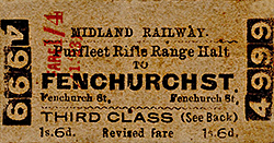 Purfleet Rifle Range was created by the war department in 1906 on the Rainham and Wennington Marshes. An untimetabled halt named Purfleet Rifle Range opened in 1911 to serve the range. It was located on the west side of Tank Hill Road level crossing. This station layout was dictated by the access point into the rifle range, including a standard gauge spur and the location of the level crossing which required the platforms to be staggered. The up platform was located between the crossing and the spur and the down platform was substantially staggered to the north. The up side was an island with a bay platform. A wide footbridge spanned the station at the north end of the up platform. It had three stairways, one to each platform with the third giving access to the rifle range. A building stood at the bottom of these steps.
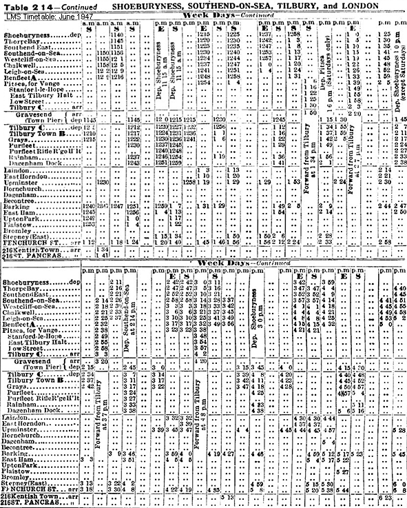
 A contemporary report describes the arrival of a troop train during the early years of WW1 "September 1914 and a train arrived at the station known as ‘Purfleet Rifle Ranges’ bearing 1,000 volunteers of Kitchener’s New Army. 300 of them were from Norfolk and had enlisted in the East Surreys. The 18th Division history records - There were not enough blankets to go round; the food was course, there were no recreation huts, no dining halls, no canteens such as the regular recruit found in barrack life. But the men’s mood was to make the best of things."
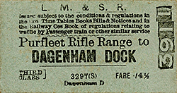 At the north end of the station on the up side a standard gauge spur curved to the south under the footbridge and into the rifle range. There was a run round loop shortly after it left the main line. The single track spur ran to a cordite store. Cordite was an important development in the late 19th century revolutionising military propellants and warfare. The cordite store was constructed in 1909 and played an important role during the First World War. The location of the store on the bank of the River Thames and its railway connections meant the cordite could be easily transported to meet wartime demands. The store consisted of substantial earth embankments surrounding a yellow brick building with a pitched roof. The embankments would have provided protection from blast if the building had blown up. Short tunnels through the embankment gave access to the building. The building was camouflaged by netting during war time which was anchored by large concrete blocks at the foot of earth bank.
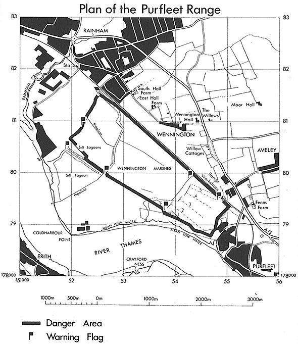
 The five 18th century gunpowder magazines remained in use throughout the 19th and 20th century until 1962, when the land was purchased from the M.O.D by Thurrock Council. Four of the five magazines were demolished in the late 1960s to make way for housing, while No.5 was used as a storage facility by the council and, since 1994, has housed Purfleet Heritage and Military Centre. The centre is open Thursdays, Sundays and Bank Holidays. The building is listed as a Scheduled Ancient Monument Grade 1. The rifle range remained in use into the 1990s. The land was sold to the RSPB in 2000. A survey of the surviving military features on the site was made by Oxford Archaeology. This was undertaken as an archaeological condition of planning approval granted to RSPB prior to scheduled works at the site. A number of surviving features have been retained within the reserve. 7 of the WW2 ammunition magazines (EAM) were demolished shortly after the RSPB acquired the site in 2000. A visitor centre was built in 2006.
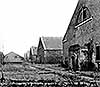

 Home Page