Station Name: NORTH GREENWICH

[Source: Nick Catford]


Looking east along Manchester Road sometime between 1910 and 1925 and more likely during the 1918 - 25 period. As indicated on the bridge, North Greenwich station is just out of view to the right. The destinations listed on the bridge are notable in that through trains to the City are implied, with Millwall Junction being of secondary stature, when in fact it was necessary to change trains at Millwall Junction. The lorry, examined on a much larger version of this image, is an Albion and almost certainly an A10. Introduced in 1910 as a 3-ton truck with 3.2 litre, 32hp petrol engine and chain final drive to the rear axle, this model was produced in large quantities for military use during WWI and following the end of hostilities many were sold off as surplus. The lorry seen here has larger, compared to the front, rear wheels and this suggests it was one of those sold off as government surplus - civilian versions usually having wheels of equal diameter if photographs are to be relied upon. The structure surmounted by a gas lamp in the middle of road has thwarted attempts to identify it but it was probably a horse trough and perhaps with a hand operated pump for drawing off water for other uses. It has been screened off and a 'Danger' sign faces the camera so perhaps some repair work on the gas supply was ongoing. Behind the area at extreme left was, in the early years of the twentieth century, the site of one of Millwall FC's many grounds. The location is today largely occupied by Manchester Grove, a residential area once described as a 'cottage estate'. Behind the tree, or remains of, on the left, was erected the mildly ornate public lavatories which, although out of use, still stand today and will be familiar to local people who have fought battles to prevent demolition. The lavatories are thought to have been erected in 1925 thus from this and the lorry we can apply a period to the photograph. Following closure of North Greenwich station, the bridge was removed but precisely when is unclear. In the 1980s it was to reappear as the Docklands Light Railway (DLR) was constructed to Island Gardens, this station originally being more or less on the site of the former North Greenwich station. The DLR station and the new bridge lasted only from 1987 until 1999 when the Lewisham extension dictated a new site, this being beyond the bridge and on the left. Island Gardens is a park, within which is located the northern entrance to the Greenwich foot tunnel. The North Greenwich branch carried a frequent passenger service but which was well known for being little used, resulting in its withdrawal along with complete closure of North Greenwich in 1926. This left the southern end of the Isle of Dogs very poorly served by public transport; the 77 tram and its replacement 677 trolley bus terminated at West India Dock and it was not until the 277 motor bus route replaced the trolley buses in 1959 that this part of the Isle gained a regular bus service. Operated initially by Leyland RTL class buses, the route ran via Westferry Road and Manchester Road to Saunders Ness Road. A local quirk is that Westferry [Road] is spelled as one word whereas East Ferry [Road] is two words. The 277 bus still operates today but via a much altered route while the Isle of Dogs, having seen a dramatic change with modern commercial and residential developments, is now far better served by public transport than it arguably ever was thanks to the DLR and additional bus routes. The scene depicted here of a century ago has, needless to say, greatly altered and the only clues to the past are the surviving part of the viaduct on the north side of Manchester Road, the public lavatories and the aforementioned cottage estate.
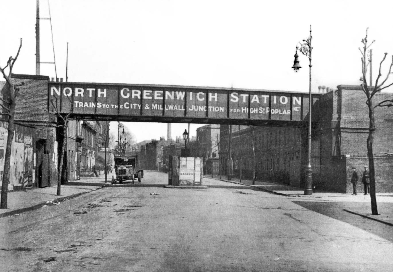
Photo from Jim Lake collection


Last updated: Thursday, 07-Sep-2017 09:05:53 CEST
© 1998-2017 Disused Stations