
Station Name: MADELEY ROAD[Source: Nick Catford]
road1.jpg) Madeley Road station looking north east from Manor Road bridge in 1952. The up platform is to the left. Having closed to passengers in 1931 the line was singled in 1934. The down platform remains in a very degraded state. The waiting shelter which was opposite the station building has been demolished. The station house was in occupation at this time.
Photo from John Mann collection 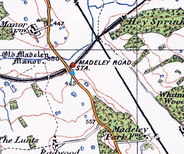 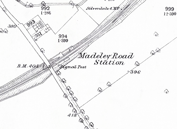
1880 1:2,500 OS map shows Madeley Road station as built. The station building, incorporating a house is on the up side with access along a footpath from Manor Road. The down platform had a waiting shelter. Although shown as a signal post, the shape of the building indicates a signal box at the back of the platform west of the shelter.
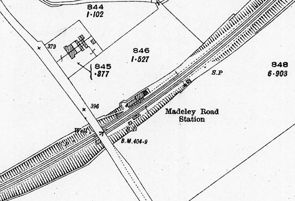
1924 1:2,500 OS map shows little change. The signal box has been moved closer to the shelter. An unknown building stands at the east end of the down platform.
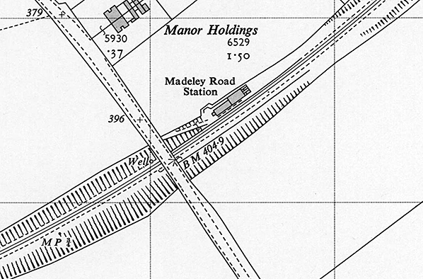 1960 1:2,500 OS map. Although closed for 29 years the map shows the station as open. The line has been singled and the shelter and signal box have been demolished. The down platform edge is still shown.
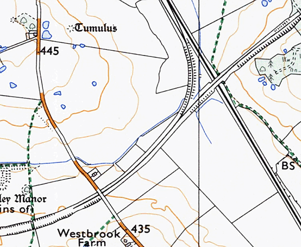
1973 1:25,000 map shows the layout of lines around Madeley Road. At this time trains arriving from Silverdale Colliery would run into Madeley Road stations and locos would run round before the train proceeded north along the Madeley Chord to join the West Coast Main Line.
road2.jpg)
In 1954 the station building is clearly occupied with a moped standing on the platform. The station garden appears well tended.
Copyright photo from John Alsop collection road10.jpg) By May 1964 the down track has been relaid and a new signal box provided on the down side, east of the station. Note the path leading up the embankment. This was the passenger access to the station from Manor Road. A new building has been provided at the east end of the up platform by the barrow crossing. By May 1964 the down track has been relaid and a new signal box provided on the down side, east of the station. Note the path leading up the embankment. This was the passenger access to the station from Manor Road. A new building has been provided at the east end of the up platform by the barrow crossing.Photo from John Mann collection road4.jpg)
A pair of BR Class 25 diesel locos running round their train at Madeley Road station having come down from Silverdale or Holditch Colliery in the mid 1970s. After running round, they descended the chord to the West Coast Main Line. The buildings are now unoccupied and in a derelict state and within a few years would be demolished. The up track has been relaid.
Photo by John Broomfield road3.jpg)
By 1981 all station buildings had been demolished leaving the degraded remains of both platforms. The new signal box on the down side has gone so was very short lived.
Photo by John Mann road5.jpg) By September 1995 a new building has appeared on the up platform. The platform edge has also been partially repaired with a step down onto the track. The purpose of this building is unknown but it clearly has a railway connection probably in relation to locos regularly running round.
Photo by Nick Catford road6.jpg)
Mainline-liveried Class 60 No. 60086 stands at the site of the former Madeley Road Station prior to running round on 09:45 Silverdale Colliery-Toton MGR. The WCML passes beneath the rear of the train and the ex NS Railway Stoke-Market Drayton Branch connected into it via the Madeley Chord in a northerly direction so the train illustrated would reverse again at Crewe on 15th December 1996.
Photo
by Geoffrey Dingle
road7.jpg)
Looking west at the new station building c1990s. The two lines converge beyond the bridge and continue for a three hundred yards.
Photo by Colin Pickford road8.jpg)
Looking west at Madeley Road station in c1990s. The platform edge on the up side was repaired when the new building was provided while that on the down side remains very degraded.
Photo by Colin Pickford road11.jpg) By 2002 the line was out of use and becoming overgrown.
Photo by Dave Ralphs road9.jpg) The overgrown line through Madeley Road station seen from Manor Road in December 2013
Photo by Eric James road12.jpg)
By 2021 undergrowth had taken over; the now derelict building can just be made out on the left.
Photo by Dave Ralphs road13.jpg)
|
 The station comprised two facing platforms. The main station building which incorporated the station master's house was on the up platform with a shelter on the down platform. Passenger access to the down platform was via a barrow crossing at the east end of the station. A signal box stood at the back of the down platform close to the west end. By 1924 the box had been located closer to the shelter. Public access was along a sloping footpath from Manor Road.
 Express Dairies had a creamery with private siding access to Pipe Gate, allowing its preferred transport partner the GWR to provide milk trains to the facility, for onward scheduling to London. Following nationalisation there was a very considerable increase in freight traffic on this route reaching a peak of 10,000 tons weekly in 1962-63.
road14.jpg)

 Home Page