
Station Name: LOW STREET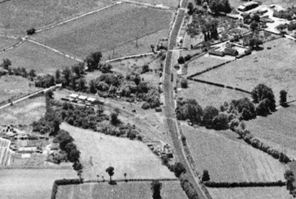 An aerial view of Low Street from July 1950. The camera is facing south-west. Low Street, now Station Road, comes in from the left and becomes Church Road after the level crossing. At top right Low Street Lane can be seen heading north-east, with Polwick's Farm in the corner formed by the road junction. Also visible is the access road to Low Street goods shed. The shed, alongside which some wagons can be seen. At the top of the image can be seen No.168 occupation crossing, still there today. Left of centre can be seen the oil storage facility, which itself provides a further mystery. Maps and plans show three sidings, two serving the storage tanks, one per side, plus a third which once crossed the road to serve a gravel pit. This view shows what appears to be an additional oil siding on the east side and some tank wagons can clearly be seen stabled on it. The siding which once crossed the road runs alongside the trees above the storage tanks but by this time stopped short of the road. The area around the oil storage tanks had itself once been occupied by gravel pits, these being the original reason for the provision of sidings. A number of cottages may be discerned. Those toward the bottom of the image adjacent to the junction with the oil sidings burned down in the early 21st century and at the time of writing still stood as derelict shells. They were described on plans as being railway cottages. A little beyond and in the 'V' formed by the junction can be seen a further cottage or a pair of. These were not shown on plans as railway cottages and were to disappear during the 1960s. There were further railway cottages in the wooded area above the oil storage tanks and the roof of one is just visible. These cottages also no longer exist. Today the area occupied by the oil storage tanks is used for cattle grazing and European Metal Recycling occupy the area toward the bottom of the image and to the left of the railway. One hint of the past which does still exist is the access road to the former railway cottages toward the bottom of the image. The road is now overgrown and blocked at its junction with Station Road.
Photo from Bratain from Above, reproduced with permission.
|

 Home Page