
Station Name: HOLMFIRTH[Source:
Alan Young]
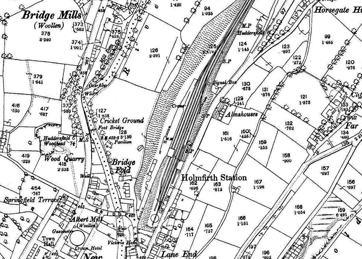 1893 1: 2,500 OS map. The station building and, to the north, the woollen transhipment warehouse (with a siding passing through) are seen east of the tracks adjacent to the north-south Station Road. Although there are two ‘running lines’, only the eastern (down) one has a platform, with a siding and bay behind it. Immediately south of the platform the lines join at the turntable: the end of the branch. West of the passenger facilities are two goods loops, the western one passing through the goods warehouse, which meet beyond the warehouse but do not re-join the running lines. A further siding from the north terminates in the warehouse. A yard crane and weigh office (WM = weighing machine) are indicated north of the goods warehouse. The approach road from Bridge Lane to the goods yard is shown. The signal box is north of the station on the down side. Holmfirth station is at the northern edge of the continuously built-up area of the town.
|
 Home Page