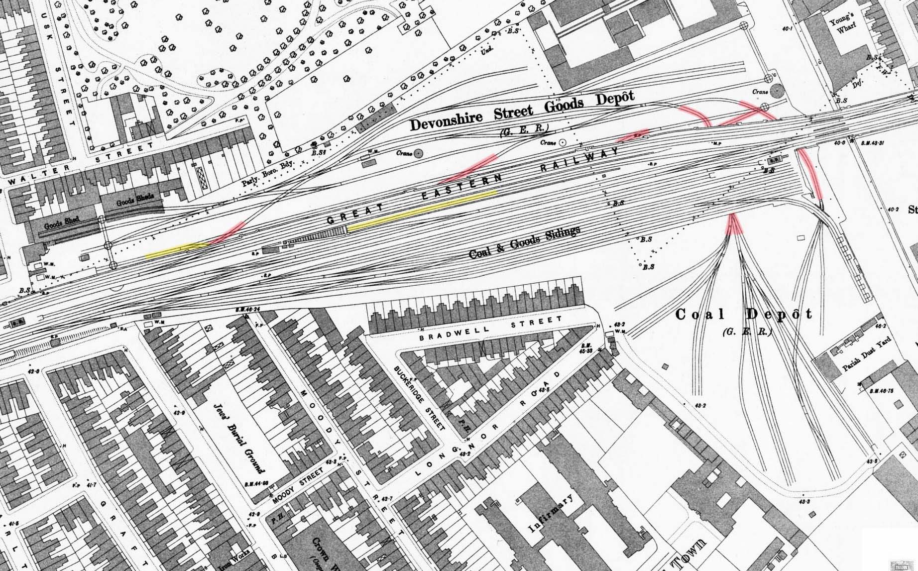
1896 1:1056 OS Town Plan. There have been many changes in the layout of the goods yard since the 1876 map. The incline (indicated in yellow) to the lower yard on the north of the viaduct has been rebuilt further west. It trails of the down fast line and immediately dives under the new lines to emerge in the lower yard. It is clear from this map that the headshunt at the foot of the incline was nowhere near long enough to accommodate a train of more than, perhaps half a dozen wagons. Much of the north yard has been re-laid and a number of lines (indicated in red) are seen passing beneath the viaduct. Two of these, at the east end, emerge on the south side of the viaduct to serve an extension of the yard on that side; the other three do not emerge on the south side and would have served the coal depot located below the viaduct. These are likely to have been connected to another line running under and parallel to the viaduct but there is no documentary evidence of this. The yard on the south side of the viaduct handled coal and building materials. As well as the original entrance to the south side, at the north end of Bancroft Road there is also an entrance with a weighbridge (WM) at the end of Longnor Road. The entrance to the yard on the north side at the end of Warley Road now has two weighbridges. The Devonshire Street coaling stage is seen on the edge of the embankment just west of the Bancroft Street weighbridge (by the letters F.A.). The siding alongside the Regents Canal at the east end of the north yard has now gone but an elevated siding continues off the end of the viaduct running above other sidings to serve coal chutes alongside the Regents Canal on the south side. Two signal boxes are shown: Devonshire Street at the west end of the yard and Canal alongside the Regents Canal.

 Home Page