Station Name: GATESHEAD EAST
[Source: Alan Young and Jonathan Clark]
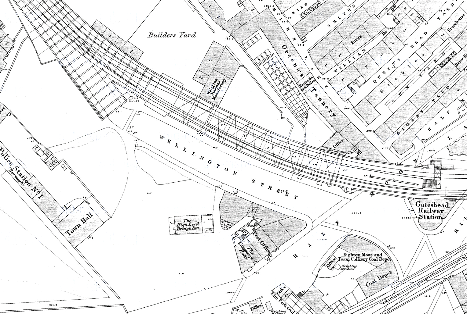 1858 1:500 OS Town Plan.Gateshead station, the forerunner of Gateshead East, can be seen squeezed into an awkward site at the south-eastern end of the High Level Bridge. The narrow, curving island platform is shown on the elevated site between the two tracks, with access probably from the north side of Half Moon Lane. In 1868, as part of the Team Valley route to Durham, Gateshead West station would occupy much of the west side of this map, requiring the removal of the Town Hall. 1858 1:500 OS Town Plan.Gateshead station, the forerunner of Gateshead East, can be seen squeezed into an awkward site at the south-eastern end of the High Level Bridge. The narrow, curving island platform is shown on the elevated site between the two tracks, with access probably from the north side of Half Moon Lane. In 1868, as part of the Team Valley route to Durham, Gateshead West station would occupy much of the west side of this map, requiring the removal of the Town Hall.
| Last
updated: Sunday, 21-May-2017 09:27:58 CEST |
© 1998-2014 Disused Stations
| |


 Home Page