
COPY PIT SUMMIT AND THE COLLIERIES FORMERLY SERVED BY THE COPY PIT ROUTE [Source: Alan Young] 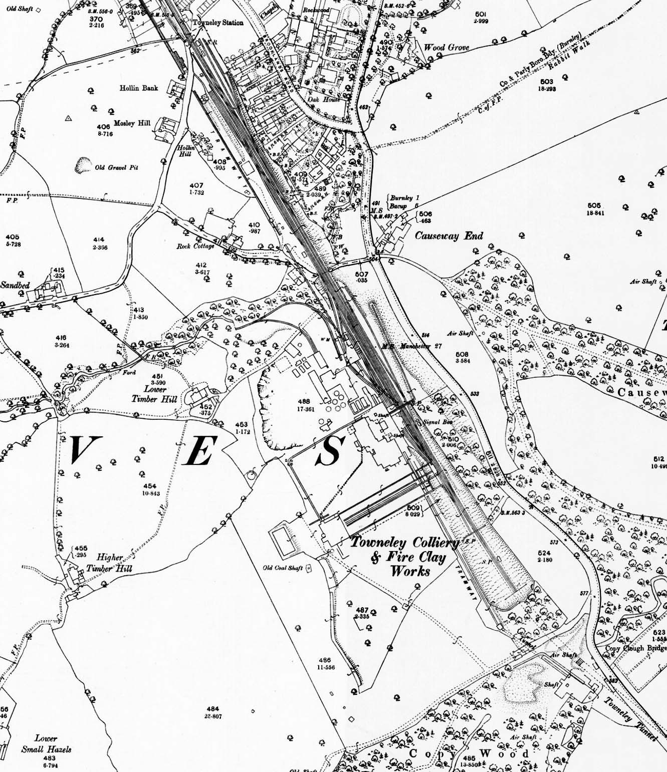 1893 OS 1: 2,500 map. Towneley Colliery and Boggart Bridge (or Boggart Brig) Pit were adjacent to the Copy Pit railway route between Holme and Towneley stations. ‘Towneley Colliery & Fire Clay Works’ is printed at the southern end of the mine’s surface buildings. Boggart Bridge Pit is not named but is close to the south-east corner of the map extract, next to Towneley Tunnel, with ‘Shaft’ and ‘Air Shaft’ labelled. A tramway is seen connecting the two mines, running parallel to the railway, and disappearing at the northern edge of the map on its way to a depot next to the Leeds & Liverpool Canal. Some mineral lines are shown within the site of Towneley Colliery and Towneley Colliery Sidings stretch from the mine as far as Towneley station, just north of the map’s border. Towneley Colliery Sidings signal box, which operated from 1878 to 1951 is shown as ‘Signal Box’. Both mines were to close in 1949. 1893 OS 1: 2,500 map. Towneley Colliery and Boggart Bridge (or Boggart Brig) Pit were adjacent to the Copy Pit railway route between Holme and Towneley stations. ‘Towneley Colliery & Fire Clay Works’ is printed at the southern end of the mine’s surface buildings. Boggart Bridge Pit is not named but is close to the south-east corner of the map extract, next to Towneley Tunnel, with ‘Shaft’ and ‘Air Shaft’ labelled. A tramway is seen connecting the two mines, running parallel to the railway, and disappearing at the northern edge of the map on its way to a depot next to the Leeds & Liverpool Canal. Some mineral lines are shown within the site of Towneley Colliery and Towneley Colliery Sidings stretch from the mine as far as Towneley station, just north of the map’s border. Towneley Colliery Sidings signal box, which operated from 1878 to 1951 is shown as ‘Signal Box’. Both mines were to close in 1949.
|
 Home Page