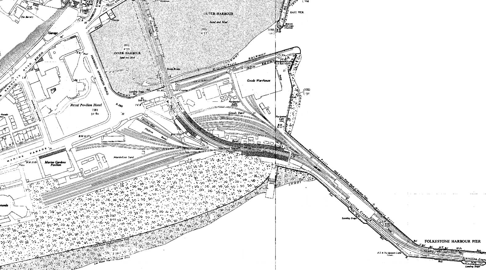
1957 1:2,500 OS map. The down platform was lengthened 1938; it was given a substantial canopy over much of its length and a new footbridge was provided at the south end of the canopy. The up platform is still split by the trailing line serving the carriage berthing sidings. A platform is shown on the north side of these sidings - presumably some kind of goods dock. The down platform extension resulted in the removal of a direct siding into the goods yard so it is now possible to enter the yard only by reversing from the pier. There are now only two signal boxes, one at the north end of the up platform and one on the pier. Click here for a larger version of this map.


 Home Page