[Source: Nick Catford] 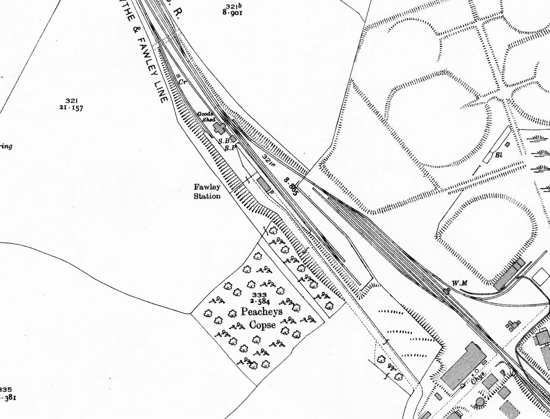 1932 1:2,500 OS map. The station is seen built into a cutting at the end of a short approach road. The platform is on the west (up) side of the line with a two-road goods yard to the north of sthe station on the up side. A goods shed with a canopy over the siding is seen and a signal box (SB) is identified between the shed and the end of the platform. The position of the yard crane (CR) is identified. There is a passing loop opposite tha platorm and a private siding into the Anglo Gulf West Indies Petroleum Corporation Limited (AGWI) refinery to the east. 1932 1:2,500 OS map. The station is seen built into a cutting at the end of a short approach road. The platform is on the west (up) side of the line with a two-road goods yard to the north of sthe station on the up side. A goods shed with a canopy over the siding is seen and a signal box (SB) is identified between the shed and the end of the platform. The position of the yard crane (CR) is identified. There is a passing loop opposite tha platorm and a private siding into the Anglo Gulf West Indies Petroleum Corporation Limited (AGWI) refinery to the east. Home Page Home Page
|