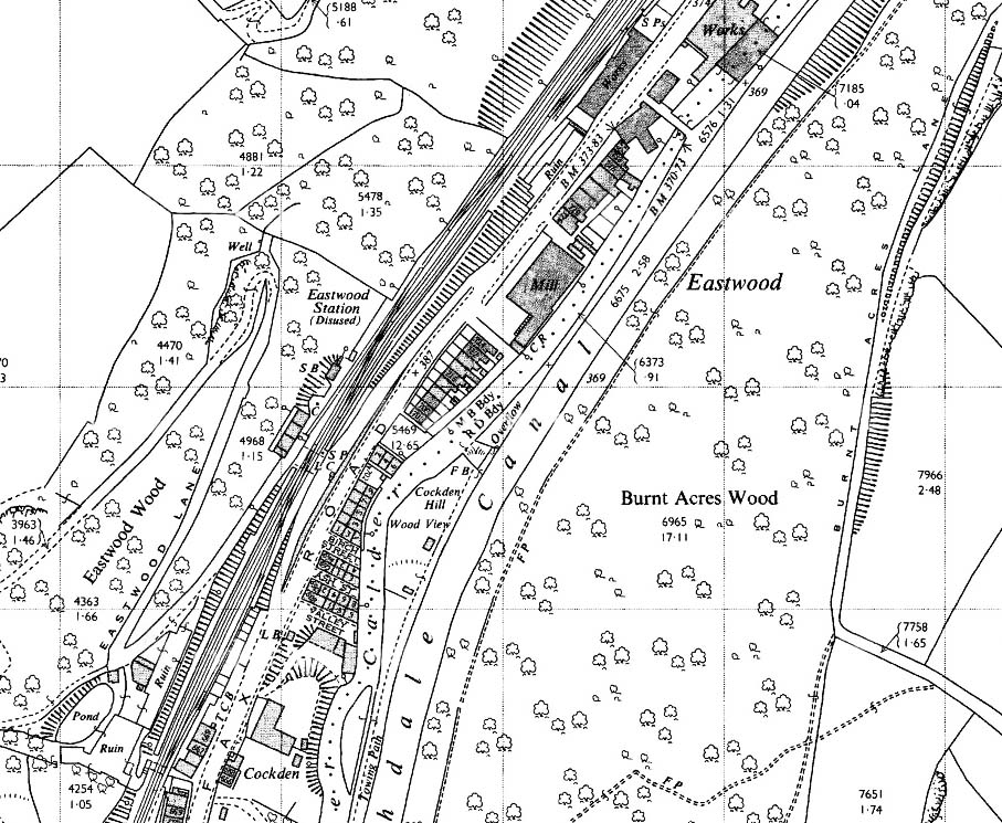
1963 1: 2,500 map. The River Calder, the Rochdale Canal, Halifax Road and the railway jostle for space in the deep, narrow valley at Eastwood between Todmorden and Hebden Bridge. Industrial housing, some of it back-to-back, and a textile mill are also squeezed in. Eastwood station, closed to passengers since 1951 but still handling goods traffic, is perched on a valley-side ledge; its main building (west of the tracks and with its internal divisions shown) backs directly onto a sheer rock face, and the adjacent signal box (SB) is located in a cleft hewn in the steep valley side. The platforms are staggered either side of the level crossing on Eastwood Lane, a narrow track that zigzags its way up the slope, formerly serving dye works as it heads for the moors. Despite the constraints of the site, space has been found for goods sidings north-east of the station, and a loop is installed opposite the Leeds-bound platform.

 Home Page