
Station Name: CIRENCESTER TOWN[Source: Peter Stephenson]
Cirencester Town Gallery 1 c1905 - 1930s
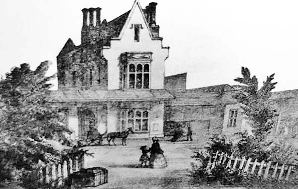 This painting is the earliest known illustration of Cirencester station and is believed to date from c1850. Although some artistic licence is assumed it probably shows the overall roof to the right of the station building. This overall roof was removed at the end of broad gauge in 1872.
The painting is in the possession of the Bingham Library Trust. 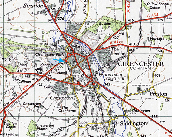 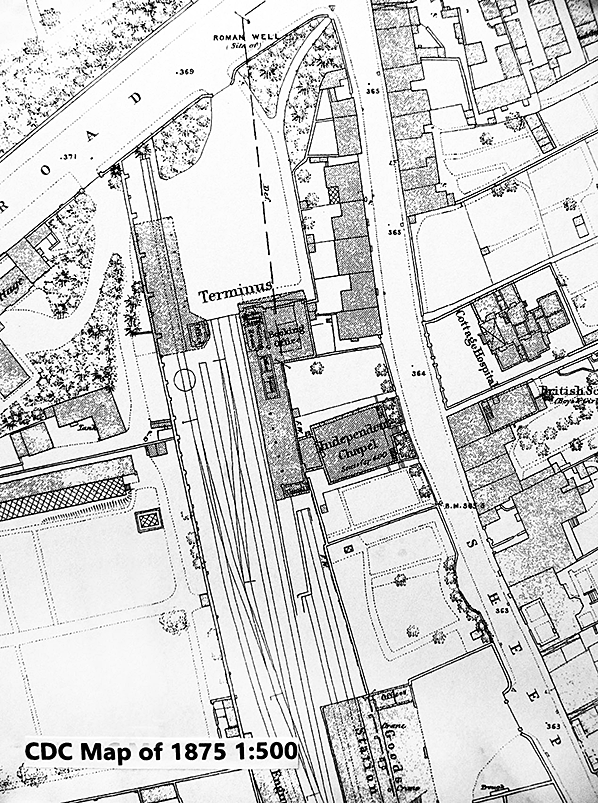
This 1:500 map of 1875 shows the station layout not long after conversion to standard gauge. The platform is straight and the run-round loop appears to use two adjacent sidings rather than the platform road. The platform itself is comparatively short. By 1902 the left hand track from the goods shed had been removed and the platform extended as far as the shed. The map shows the canopy along the station frontage and a further canopy along the left (west) side. Both were probably left when the main overall roof was removed. The map also shows houses on both sides of Sheep Street. Those backing on to the station forecourt have since been demolished. Click here to see large version
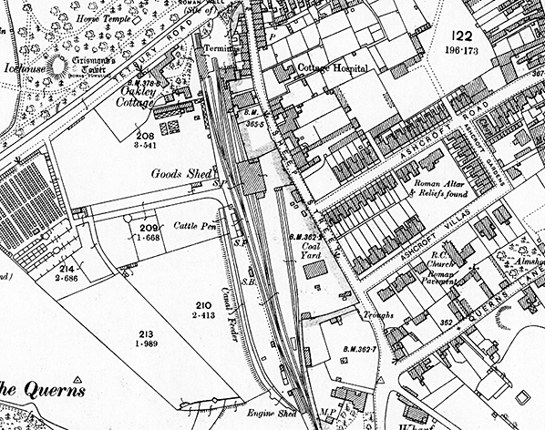
1902 1:2,500 OS map.. Compared with the 1875 map, the run-round loop now uses the platform track which is curved near the buffer stops, and the platform is extended to reach the goods shed. The map shows the original size of the goods yard, i.e. before the c1920 enlargement. The road overbridge at the bottom of the map remained until closure and formed the view point for many photographs. The wharf marked towards the right hand half of the map, towards the bottom, was on the Cirencester arm of the Thames and Severn Canal.
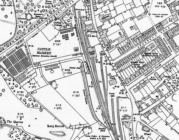 1932 1:2,500 OS map. This shows the extent of the station area after the c1920 alterations. The platform is straight and the goods yard has been significantly enlarged. However, this map, like all OS maps from 1920 onwards, omits the two double slips introduced into the goods yard. They are, however, visible in a number of photographs and the SBS signal box diagram.
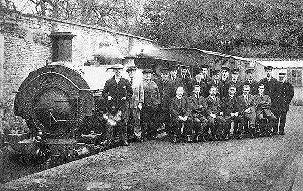 Cirencester Town station staff pose for a camera in the early years of the 20th century beside an unidentified saddle tank and two horse boxes at the end of the line.
Photo from Bristol City Museum and Art Gallery 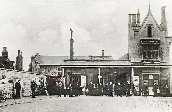 This is the only known photograph of station frontage pre-1946, and is dated c1905. The three-storey building to the right is recognisable from what is there today. The photograph shows the original single storey, complete with tall chimney and a glimpse of the original fan light. The original canopy is along the station frontage. The buildings to the left behind the stone wall are the houses which then stood on the station side of Sheep Street. The building behind the tall chimney is marked on maps of the time as 'independent chapel'. It dominates photographs of the station platform and is still there today.
Photo from Lens of Sutton collection 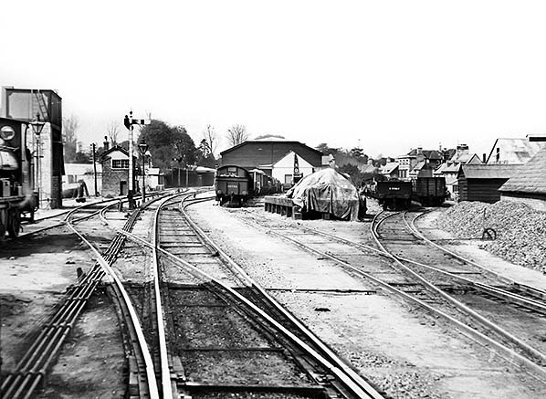
Photograph of goods yard, probably dated 1900-1910 although it has been dated around 1930. It appears to have the pre-1920 track layout and the goods wagons also suggest the earlier date. On the extreme left is part of what appears to be a saddle tank. Looking from there along the down (left hand) side are the water tower and signal box and, in the distance, what is thought to be part of the original overall canopy. The photograph shows the original goods shed. The goods yard is busy, so it is perhaps not surprising that it was subsequently extended.
Photo from Corinium Museum, Cirencester 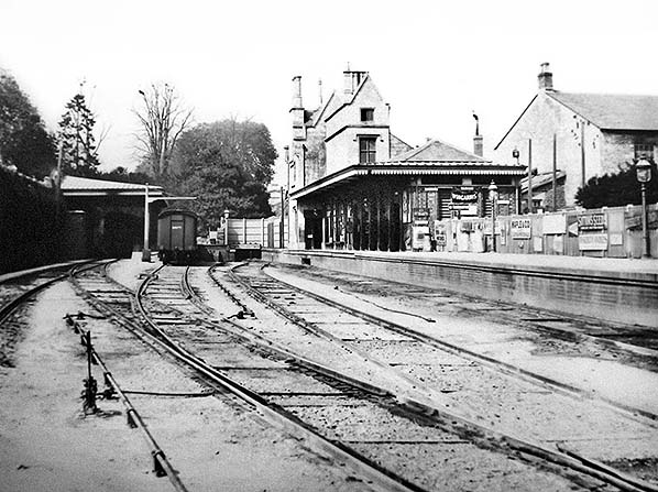
A photograph of the station c1910. It shows the original platform awning, wooden stockade round the end of the track, Y-point plus reverse curve at the end of the platform, and what appears to be the last section of the overall canopy to the left. The Independent Chapel is the large building to the right and the trees of Cirencester Park can be seen on the far side of Tetbury Road.
Photo from Corinium Museum, Cirencester 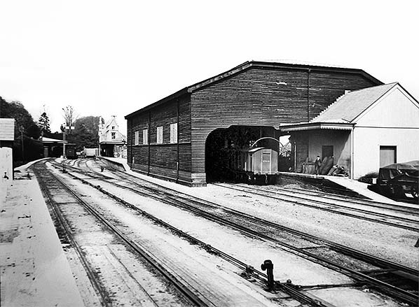
This is the best known photograph of the original goods shed. It was probably taken at the same time as the previous photograph, i.e. c1910. It shows the key features of the original goods shed. There are two tracks into the shed but only one with an unloading platform. It is timber built. For a single platform branch line terminus, it is large, as can be seen in comparison with the covered van. The photographer appears to be standing on the cattle pens which were just off the left hand side of the photograph. The white building adjoining the goods shed is labelled 'Grain Platform' on a contemporary site plan.
Photo from Corinium Museum, Cirencester 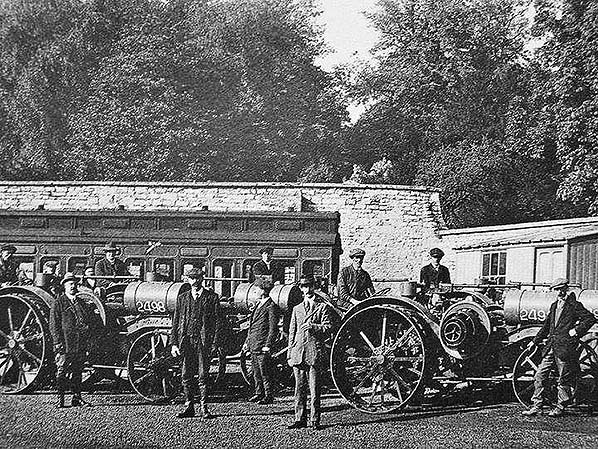 At the time of the First World War Britain was still reliant for the most part on horses for agricultural purposes and the industry was very labour intensive, while food imports and especially grain all but ceased. With men and horses sent away to war along with the need to dramatically increase domestic food production, the Government decided to import internal combustion tractors from the USA. The primary purpose of the tractors was to plough up grassland to allow food to be grown, a situation which was to repeat itself during the Second World War. The tractors seen in this view at Cirencester are International Harvester (IH) Titan 10 - 20 models. The Titan was imported in large numbers. The John Deere 'Waterloo Boy', which was rebranded as the 'Overtime' for British use, also appeared in large numbers. The Titan was manufactured at the IH factory in Milwaukee, Wisconsin, the former Deering factory which company IH had taken over. The Titan 10 - 20 was a two-cylinder horizontal petrol/paraffin machine, meaning it was started on petrol and once warmed up switched to paraffin a once very common arrangement. The engine produced 20hp at 575rpm, giving 10hp at the drawbar and 20hp at the belt pulley. It had two forward and one reverse gear with a maximum speed of 2¾mph in second gear. The tank, which was of 40 gallon capacity, seen here on the front of the tractors was for water and acted as the engine cooling radiator. The imports were controlled by, perhaps surprisingly, the Ministry of Munitions and the numbers painted on the tanks were probably applied at this Ministry's request. Ordinarily the 'Titan' name along with other information was applied horizontally to the water tanks just above the centre line and the application of the numbers below the centre line suggests the 'Titan' name was present, although the photograph shows no obvious sign of it. The Titan dated from 1915 and the British order was placed sometime during 1917, with IH completing the order in April 1918. What is not known is whether the photograph shows new tractors on delivery or if the tractors are being moved to Cirencester from elsewhere in the country. Their condition, insofar as can be determined from such an old photograph, suggests they were new. This in turn means we can cautiously date the photograph to sometime in the 1917 - 1918 period, more likely during the latter year allowing for manufacturing and shipping time. The wall in the background gives the location away, it is the north-west corner of the station site and the tractors are sitting on the northern extremity of the goods dock. The west face of the dock was served by a siding which extended almost to Tetbury Road, out of view to the right behind the hut which today no longer exists. This is the siding on which the Dean clerestory coach is sitting, but the reason for its presence at this particular spot is not known.
Photo from Derek King collection 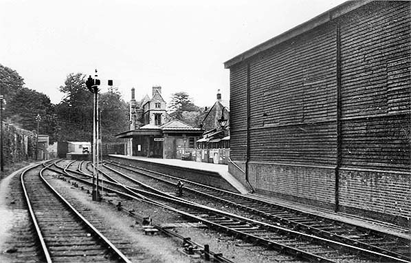 This is a general view of the station looking north and is dated 8 June 1934. The original wooden goods shed is on the right. Various changes can be noted from the 1910 photographs. The goods shed windows have been blocked. The platform and platform track have been straightened. The platform canopy has been extended outwards to reach the new platform edge. The canopy now has two peaks; the right hand one is the tiled original, as in the 1910 photographs, and the left-hand one is glazed. There is an unusual lattice signal, acting as down inner starter. The wooden fence at far end of platform is still there, but the canopy along the far right hand wall has gone. The covered wagons behind the platform are on the track extending out of the northern wall of the goods shed.
Photo from John Mann collection 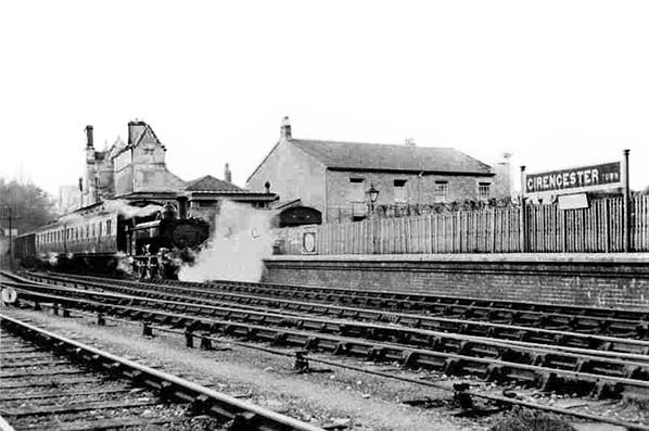
One of the few photographs taken in the 1930s. It is of a train leaving Cirencester Town for Kemble. It is dated 9 April 1936. The train is hauled by a GWR pannier tank and appears to consist of a B-set plus some covered vans. Also, there is at least one covered van on the track behind the platform.
Photo from WA Camwell collection 28948.
|
 On the opening day, Cirencester Town station consisted of a narrow three-storey building with a single storey extension to the left, as seen from the road frontage. The three-storey building is still in existence but the single storey extension was substantially rebuilt in 1956. To the right was the single platform and a number of parallel tracks. There was a canopy along the front of the station that lasted until about 1948 and an overall roof over the platform and tracks. Most of the overall roof was removed in 1872.when the line was converted from broad to standard gauge. The wall down the right hand side of the car park (seen from the Tetbury Road) has always been the western edge of the railway lands. It supported the original overall roof.
 The original goods shed (1841) was of timber construction and large for a single platform branch terminus. It had the curious quirk of some GWR goods sheds of the time, namely two tracks within it, but with only one track adjacent to a platform. Other examples were Ross-on-Wye, Bradford on Avon, Challow and Newbury. The main goods yard was south and east of the passenger station. It was significantly enlarged around 1920. This included several new sidings. It also included two double slips, which was unusual for a branch line terminus. A complication here is that the relevant OS maps, and consequently other maps drawn from it, omit this point work. It is however clearly visible in photographs. The goods shed was replaced in 1938 by one with a steel-frame structure and only one internal track. The other track formed an external siding between the goods shed and the main running line.
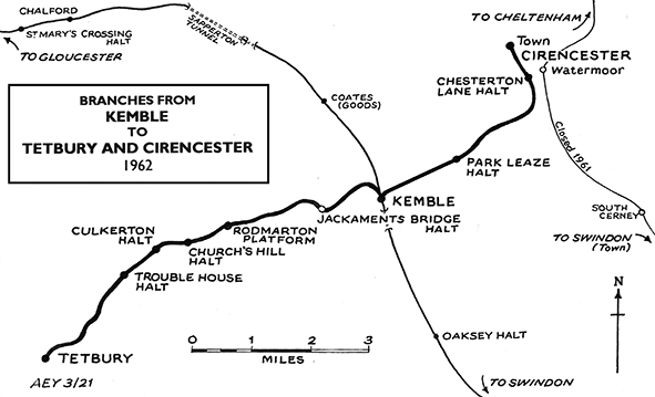
 Daniel Bingham (1830-1913) of Cirencester started his career at Cirencester Station and ultimately had a major role in the railways of the Netherlands. He became General Manager of the Dutch Rhenish Railways. His patron James Staats Forbes also worked at Cirencester. Daniel Bingham was a generous benefactor in Cirencester towards the end of his life viz:- Bingham House Gallery/ Library and Bingham Hall.
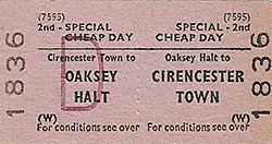 The Squire of Kemble in 1841 objected strongly to the C&GWUR. As a result, an unnecessary tunnel had to be built on the main line just south of Kemble to hide the railway, and the initial Kemble station was a simple affair that merely permitted transfer between branch and main line trains. A separate station, initially called Tetbury Road and later Coates, was built just north of the A33 and off the Squire’s land. As a result, Kemble had sufficient sidings for transfer of goods trains to and from the Cirencester and Tetbury branches, but handled little other freight. It also explains why the delightful Kemble station buildings, still in good condition, date from 1882
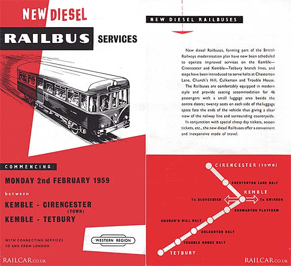
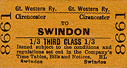
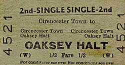
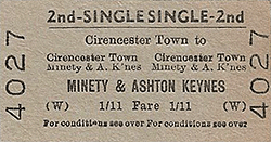 The branch was worked by a shuttle service between Cirencester Town and Kemble. It is likely that poor connections at Kemble with trains to Swindon, Paddington, Gloucester, Cheltenham and Tetbury discouraged traffic. The most frequent service in steam days was just before WWII and consisted of 10 up and 11 down trains on weekdays, 5 more on Saturdays and a total of 7 trains on Sundays. The first Sunday train was early afternoon, and the Sunday service finished around midnight with connections to and from the Neyland mail and passenger. The Neyland train would have been diverted via Gloucester because the Severn Tunnel was closed on Sundays. The Cirencester connection was apparently run for Services personnel. The railbus service provided 13 trains each way weekdays and 16 on Saturdays.
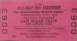 This is the only known photograph of station frontage pre-1946, and is dated c1905. The three-storey building to the right is recognisable from what is there today. The photograph shows the original single storey, complete with tall chimney and a glimpse of the original fan light. The original canopy is along the station frontage. The buildings to the left behind the stone wall are the houses which then stood on the station side of Sheep Street. The building behind the tall chimney is marked on maps of the time as 'independent chapel'. It dominates photographs of the station platform and is still there today.
 Home Page