
CHEQUERBENT INCLINE MAP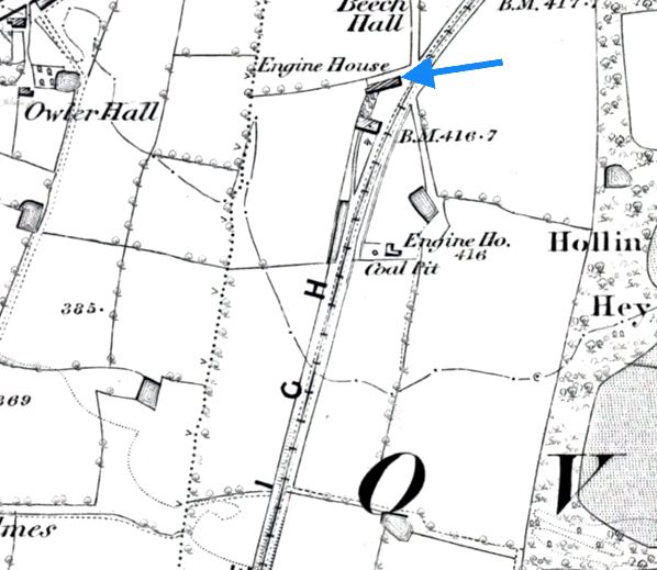
A section of the Chequerbent incline shown on a 6-inch scale map from 1845. The blue arrow indicates the stationary engine house. The stationary engine powered the ropes that were used to work the incline in the early years of the line.
 Home
Page Home
Page
|