
HULTON COLLIERIES
CHEQUERBENT PITS MAP
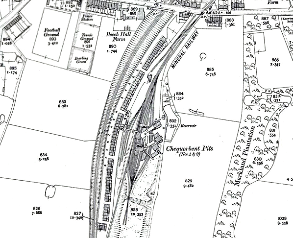
The Hulton Colliery Company Chequerbent Pits Numbers 1 and 2 shown on a 25-inch scale map from 1907. The pit closed in 1927 after the General Strike. The The original course of the B&L railway had been used to provide rail access to the pit. The 1885 alignment of the line can be seen to the right of the mine. After closure of the pit the original B&L line was retained for tipping purposes.
 Home
Page Home
Page
| Last updated:
Wednesday, 17-May-2017 09:08:59 CEST
|
© 2004-2017 Disused Stations
|
|