
Station Name: BRITANNIA[Source:
Alan Young]
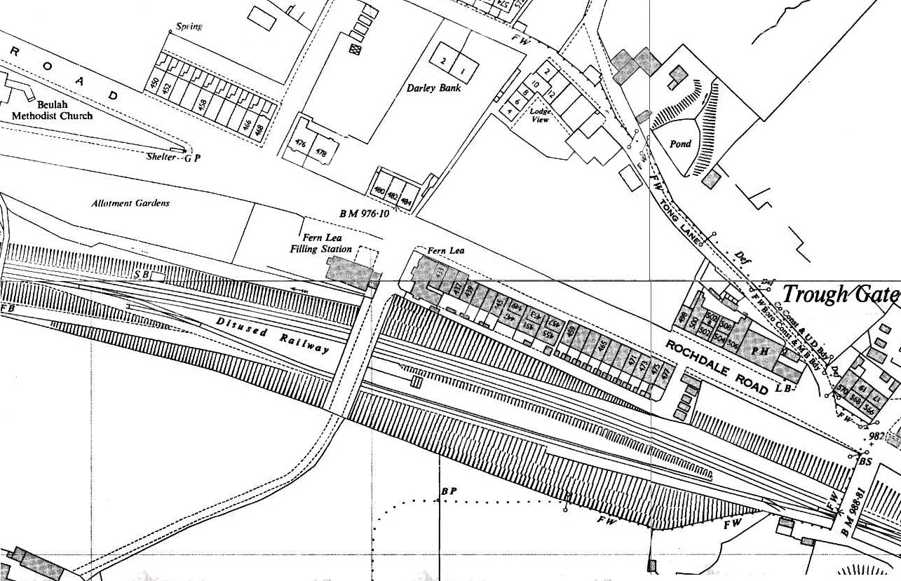
1960 1: 2,500 OS map. The survey probably dates from the mid 1950s. The railway is now shown to be disused and sidings have been removed. Britannia station’s platform is shown but the northern (up) face has lost its edge stones as a slope is shown rather than a crisp edge: photo evidence confirms that this had happened. A fragment of the staircase is the only other structure surviving at the station. On the moors beyond this map extract to the west and south some quarries have now closed and are being used for disposal of refuse.
|
 Home Page