
Station Name: BRITANNIA[Source:
Alan Young]
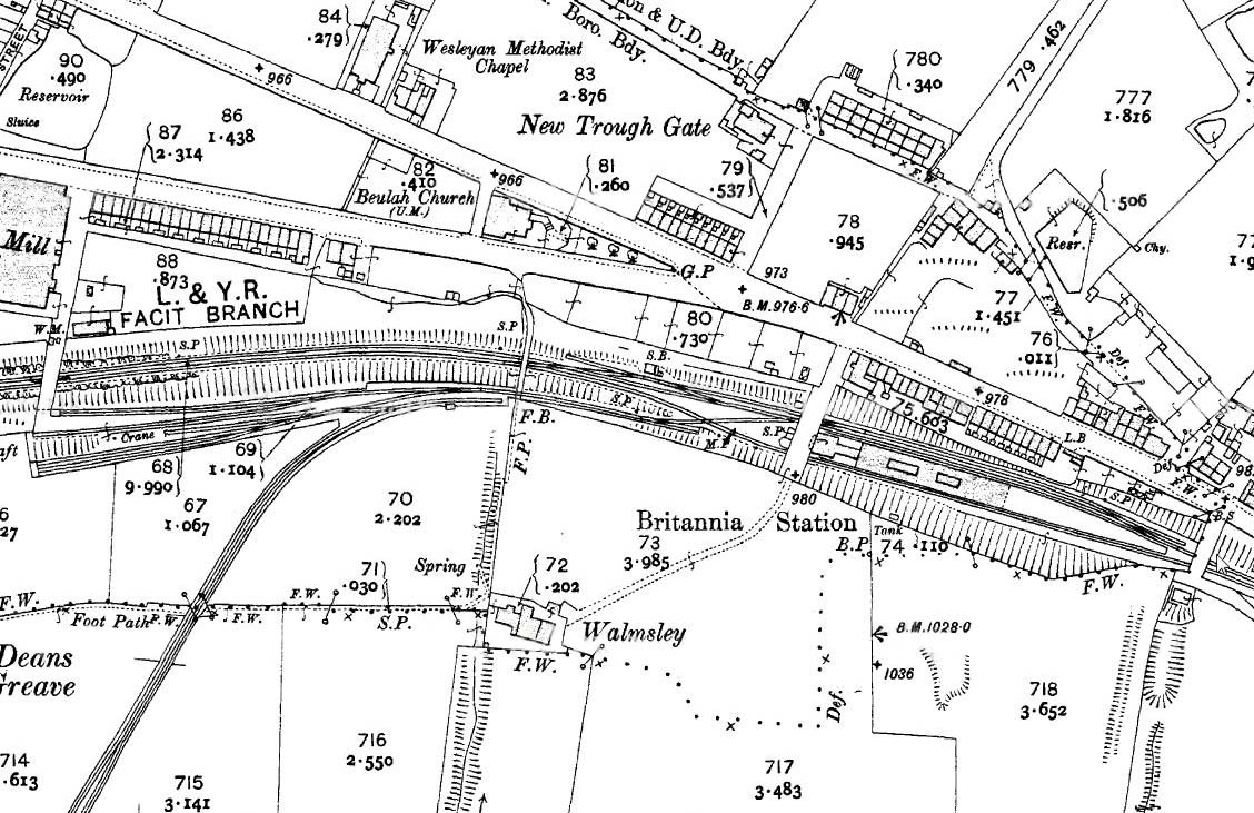
1910 1: 2,500 OS map. Uniquely among the intermediate stations on the Facit Branch, Britannia had an island platform. The booking hall is shown east of the road overbridge, and the shaded area includes the staircase (covered?) down to the platform and the awning which extended about half the length of the platform is shown by pecked lines. The small buildings beneath the awning are also marked. Sidings are located to the west on the down side (south of the running lines) and a standard gauge tramway extends southwards off the map to serve some small coal pits and the Britannia Quarries. The signal box is identified between the two overbridges west of the platform. Some of the neighbouring terraces are shown to be ‘back-to-back’, including the cluster on Market Street close to the bridge at the east end of Britannia station. The road south of Beulah Chapel is called ‘New Line’, referring to the adjacent railway: it was ‘new’ in comparison to the Irwell Valley route to Bacup and the Rochdale-Facit section. The village of Britannia, named after an inn, includes scattered terraces and two Methodist churches. Unless they were employed in the mills, many of the men of the village will have trekked uphill to work in the quarries or pits each day. In the year after this map was published a street tramway, connecting Rochdale and Bacup, was opened and it followed Market Street immediately north of Britannia station.
|
 Home Page