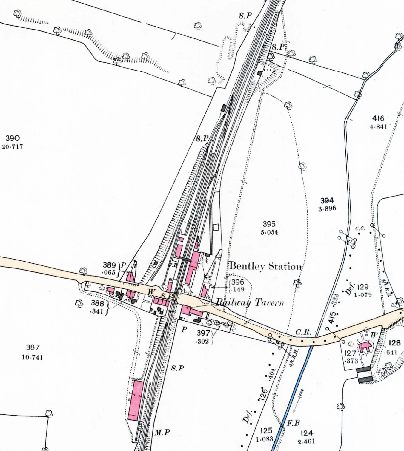
1892 1:2,500 OS map. This map clearly shows the complex layout of Bentley station with sidings on both sides of the line. The station was located on the north side of the Station Road level crossing with the Down platform and Bentley branch bay platform on the west side of the line and the Up platform on the east side. The main station building is on the Up side, the large building also incorporates a goods shed at its north end. A smaller waiting room and gents' toilet stands opposite on the Down platform. A footbridge spans the line between the two buildings. Two diverging cartage sidings are provided on the down side running on the west side of the bay road. On the Up side terminates at the north end of the goods shed while another siding runs diagonally south-east from this siding running past a small cattle pen. Two signal posts are shown on the down side and the signal box is shown but not identified at the north end of the cartage sidings alongside the bay road. The branch line continues north alongside the main line. The Railway Tavern is identified on the south side of the level crossing on the up side. South of the station Wilson's siding is seen on the Down side serving an unidentified Malthouse.


 Home Page